A utility corridor can fail long before the failure is visible. The problem is rarely a lack of data. It is usually the wrong survey method, applied at the wrong stage, with outputs that cannot stand up to engineering review. That is why selecting the top survey methods for utilities is not a procurement detail. It is a project risk decision with direct implications for design accuracy, outage prevention, safety, and capital efficiency.
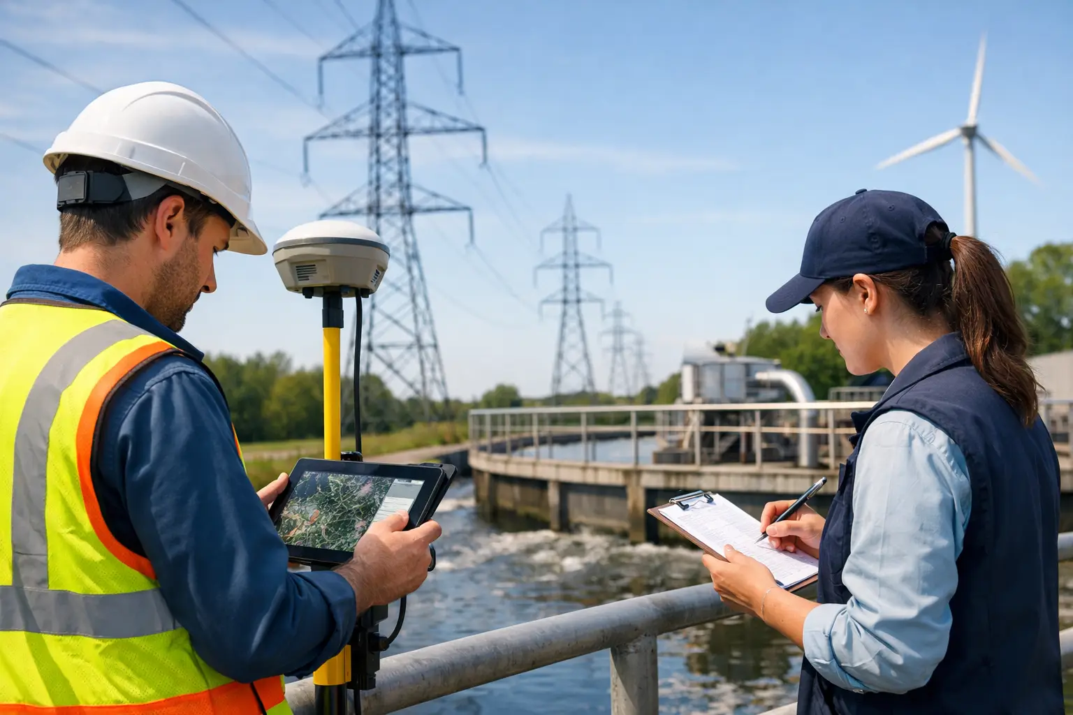
For utilities, no single sensing method is sufficient across planning, expansion, inspection, and maintenance. Overhead transmission lines, buried power cables, substations, pipelines, stormwater networks, and water distribution assets each present different visibility constraints and technical requirements. The right survey strategy depends on what must be detected, the operating environment, the required positional accuracy, and whether the final deliverable is intended for screening, engineering design, or regulatory documentation.
What makes a utility survey method decision-grade
Utility owners and EPC teams are not buying imagery for its own sake. They need calibrated, traceable, and fully auditable outputs that reduce uncertainty in field conditions. A method becomes decision-grade when it can reliably answer a specific operational question - where an asset is, what condition it is in, how it interacts with adjacent infrastructure, and what constraints exist around it.
That standard immediately rules out a common mistake: choosing a method because it is fast rather than because it is appropriate. Fast mobilization matters, especially for active corridors and constrained construction windows, but speed without validation creates downstream rework. In practice, the best-performing utility programs pair rapid airborne acquisition with targeted ground verification and disciplined QA/QC.
Top survey methods for utilities by asset type and use case
The top survey methods for utilities are best evaluated as a toolkit rather than a ranked list. Each method resolves a different part of the asset picture.
LiDAR for corridor mapping and clearance analysis
LiDAR is one of the most effective methods for utility corridor characterization. It provides high-density elevation data that can be used to model terrain, structures, vegetation encroachment, conductor sag, access constraints, and drainage interactions. For transmission and distribution operators, this is essential for right-of-way management, route selection, and asset proximity analysis.
Its main strength is geometric reliability. Unlike image-only methods, LiDAR performs well where surface texture is inconsistent and where vegetation complicates line-of-sight interpretation. It is particularly valuable in desert and mixed-terrain environments where ground conditions shift rapidly and engineering teams need accurate digital terrain models rather than visual approximations.
The trade-off is cost relative to simpler image capture, and the fact that LiDAR alone does not identify all subsurface conflicts. It tells you where the ground and above-ground assets are with high precision. It does not, by itself, tell you what is buried beneath that surface.
UAV photogrammetry for rapid visual intelligence
Photogrammetry remains a highly practical utility survey method when the objective is fast orthomosaic generation, 3D surface modeling, and visual documentation of sites, corridors, and facilities. It is often the most efficient way to establish current surface conditions before construction, document asset exposure during works, or create a visual baseline for claims and progress monitoring.
For utility programs, photogrammetry works well in substations, treatment sites, solar infrastructure, linear access routes, and civil interface zones where high-resolution image products support planning and communication across engineering and project controls teams. It can also complement LiDAR by adding visual context to geometric data.
Its limitation is that accuracy depends heavily on control quality, flight design, lighting, and surface characteristics. Uniform terrain, reflective surfaces, and low-feature areas can reduce model confidence. Photogrammetry is useful, but it should not be treated as a substitute for LiDAR where vertical precision or vegetation penetration is a critical requirement.
Ground penetrating radar for buried utility detection
When buried assets are the main concern, ground penetrating radar is a core method. GPR is widely used to identify subsurface utilities before excavation, trenching, directional drilling, and civil expansion. For electricity, telecom, water, and district cooling networks, it reduces the chance of strike events and supports safer construction planning.
GPR performs best when the target depth, soil conditions, and material properties are favorable. It can detect non-metallic utilities that electromagnetic locators may miss, which makes it especially valuable in mixed legacy networks. In urban utility environments where record drawings are incomplete or outdated, that matters.
The constraint is environmental sensitivity. Wet clay-rich soils, congested subsurface conditions, and deep or poorly contrasted targets can reduce interpretability. GPR is highly useful, but it requires trained processing and disciplined field procedures. Raw scans are not enough. The value comes from interpreted outputs cross-validated against known features, access records, and where necessary, selective proofing.
Electromagnetic locating and mapping
Electromagnetic methods are a standard choice for tracing conductive buried assets such as metallic pipes, cables, and energized lines. They are efficient for route confirmation, utility avoidance planning, and network verification, especially when the objective is to trace continuity over distance rather than generate broad subsurface imaging.
For utility owners managing legacy networks, electromagnetic locating is often the first pass because it is fast and operationally practical. It works well for energized systems and conductive infrastructure with traceable signal paths. In many projects, it is paired with GPR to improve confidence and distinguish between conductive and non-conductive assets.
Its weakness is equally clear. If an asset is non-conductive, disconnected, deeply buried, or heavily congested by adjacent infrastructure, electromagnetic response alone may be incomplete or ambiguous. It is best treated as one layer in a multi-sensor utility detection workflow.
Bathymetric and hydrographic survey methods for water utilities
Water utilities and drainage agencies face a different problem set. Channels, reservoirs, outfalls, culverts, and retention structures require accurate elevation and depth information to support hydraulic modeling, dredging assessment, flood mitigation, and capacity planning. In these environments, hydrographic and bathymetric methods become essential.
Depending on site conditions, this may involve sonar-based acquisition, drone-supported surface mapping, or integrated topographic-bathymetric workflows. The benefit is continuity between dry-ground terrain data and submerged asset or channel geometry. For stormwater and wastewater programs, that continuity supports more defensible hydraulic analysis.
The challenge is operational complexity. Turbidity, flow conditions, access constraints, and bank geometry all affect acquisition quality. These surveys require tighter planning and stronger control of field variables than a standard dry-land topographic mission.
Thermal and visual inspection for operational asset condition
Not every utility survey is about location. Many are about condition. Thermal imaging and high-resolution visual inspection are increasingly used for overhead line anomalies, substation hotspots, panel defects, mechanical wear, insulation issues, and water loss indicators in certain surface conditions.
For utilities operating critical infrastructure, the advantage is obvious: defects can be identified without taking assets offline or exposing personnel to unnecessary field risk. UAV-based inspection is particularly effective where access is difficult, hazardous, or expensive using conventional climbing, shutdown, or manned aviation methods.
Still, thermal data is only as good as the inspection protocol. Load conditions, weather, emissivity assumptions, and viewing angle all influence results. A thermal anomaly is an indicator, not a diagnosis. It should be integrated with asset history and maintenance records before major decisions are made.
How to choose among the top survey methods for utilities
The right selection starts with the decision that the data must support. If the requirement is route design across undeveloped ground, LiDAR and photogrammetry may be the correct front-end package. If the risk is buried utility conflict before excavation, GPR and electromagnetic mapping are more relevant. If the concern is operational integrity of overhead assets, thermal and visual inspection move to the front.
Accuracy tolerance is the next filter. Planning-grade outputs are not the same as construction-grade deliverables. A utility owner may accept broad screening data for early corridor assessment, but not for final engineering. That distinction should be defined before acquisition begins, not after data is collected.
Then there is site reality. Congested urban corridors, remote desert infrastructure, energized facilities, and water-adjacent assets each narrow the field of practical methods. A technically strong contractor will not force one platform into every assignment. The better approach is method selection based on asset physics, terrain, access, and reporting requirements.
For many enterprise programs, the highest-value answer is a fused workflow. Airborne LiDAR, UAV imagery, GPR, electromagnetic tracing, and interpreted geospatial reporting can be combined into a single utility intelligence package with documented QA/QC and traceable confidence levels. That approach costs more upfront than a single-method survey, but it often reduces total project cost by limiting redesign, field surprises, and avoidable construction delays.
Utilities are under pressure to expand capacity, harden networks, and execute faster without compromising safety or auditability. The survey method should match that pressure. When the sensing strategy is aligned to the asset, the environment, and the decision threshold, the data becomes more than a site record. It becomes a controlled input for action.