Aeromagnetic
Surveys.
High-resolution airborne magnetic anomaly mapping for the detection of mineral deposits, fault systems, and geological structures. Deployed across the Arabian Shield, Najd Plateau, and arid exploration corridors where ground access is operationally prohibitive.
- Sensor
- Caesium vapour magnetometer
- Sensitivity
- 0.001 nT
- Line spacing
- 25–200 m
- Ground clearance
- 30–60 m AGL
- Coverage
- ~80 km²/day
Sub-surface mapping at flight altitude.
The Arabian Shield is one of the world's most prospective basement terranes — and one of the hardest to ground-access. Drone-borne magnetic surveys close that gap, resolving anomalies at altitude where vehicle-based methods are slow, expensive, or simply not feasible.
Our caesium-vapour platform captures total-field magnetic intensity to a sensitivity of 0.001 nT. We fly tight grids at low ground clearance, then process the data through diurnal correction, IGRF removal, levelling, and micro-levelling — before our interpretation team converts the residual field into a structural and lithological model.
The output is not raw data. It is an interpreted geophysical product: maps of magnetic susceptibility contrasts, derived structural lineaments, depth-to-source estimates, and ranked drill targets — all delivered with full QA/QC traceability.
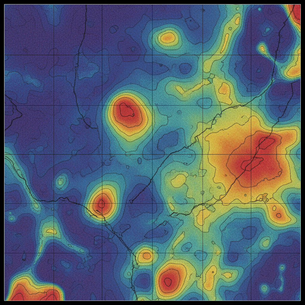
Magnetic anomaly grid
Levelled, micro-levelled TMI with contoured magnetic lineaments — the basis for structural interpretation and depth-to-source modelling.
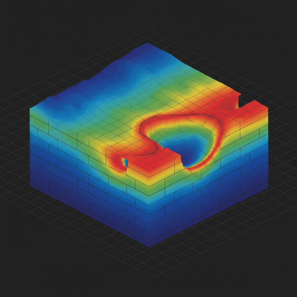
Susceptibility volume
Diurnal correction → IGRF removal → levelling → micro-levelling → RTP → analytical signal & derivatives → Euler depth solutions → 3D susceptibility inversion.
From flight plan to drillable target.
Flight Planning & Airspace
Block design, line orientation, GACA permits, and ground reference selection. Detailed risk assessment for desert and remote corridors.
Airborne Acquisition
UAV-mounted magnetometer flown along pre-planned grid. Continuous diurnal reference at the base station for time-domain correction.
Processing & Noise Removal
Diurnal correction, IGRF removal, levelling, micro-levelling, RTP, and analytical-signal derivatives. Full processing log archived.
Interpretation & Report
Structural lineament extraction, depth-to-source modelling, drill-target ranking. Geological report delivered to client geologists.
What you receive.
Total-field intensity grid
Levelled, micro-levelled, IGRF-corrected. GeoTIFF + raw.
Analytical signal & derivatives
1st & 2nd vertical derivatives, tilt derivative, RTP.
Structural lineament map
Vectorised faults, contacts, dyke swarms with strike statistics.
Depth-to-source model
Euler deconvolution / Werner depth solutions with confidence bands.
Drill-target ranking
Priority-ranked anomalies with rationale and coordinates.
Final report + QA/QC log
PDF report, processing log, calibration records, chain of custody.
Where this service is deployed.
Map your block.
Share your area of interest and target depth. We respond with line spacing, schedule, and pricing within 48 hours.