Hyperspectral
Surveys.
VNIR/SWIR spectral imaging for surface mineralogy classification, vegetation stress mapping, and hydrocarbon seep detection. 270+ spectral bands resolved at sub-metre ground resolution.
- Sensor
- VNIR-SWIR pushbroom
- Spectral bands
- 270+
- Spectral range
- 400–2500 nm
- Ground resolution
- 0.5–2 m
- Coverage
- ~30 km²/day
Spectral geology from the air.
Most surface materials — clays, iron oxides, carbonates, sulphates, hydroxides, vegetation under stress, hydrocarbon seeps — carry diagnostic spectral signatures in the VNIR and SWIR range. Hyperspectral imagery resolves those signatures at survey speed.
Our pushbroom VNIR-SWIR systems capture 270+ contiguous spectral bands at sub-metre ground resolution. Atmospheric correction, geometric correction, and spectral library matching are applied per project objective — whether that's alteration mapping for mineral exploration, dryland vegetation health, or seep detection over hydrocarbon plays.
Output is a classified surface map tied to your coordinate system, supported by spectral end-member library and per-pixel classification confidence.
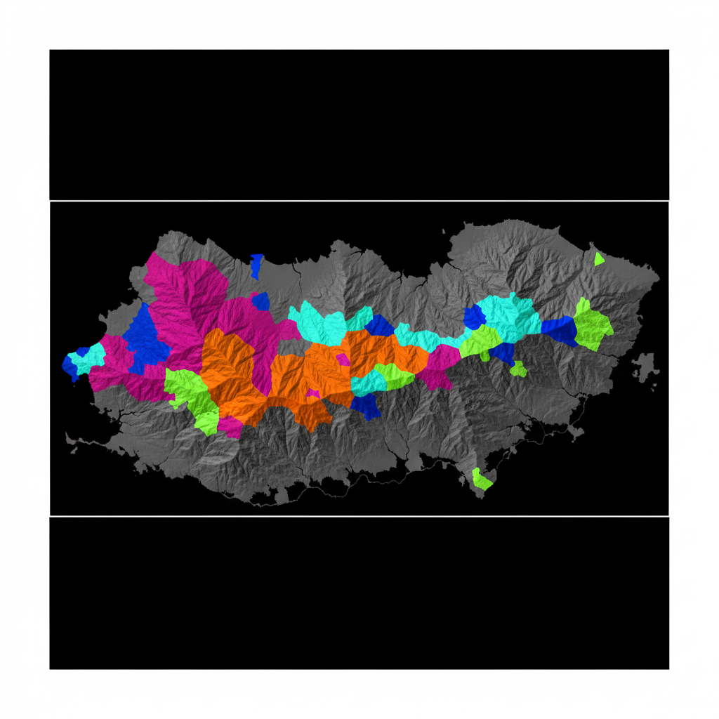
Mineral alteration map
VNIR-SWIR classification separating clay, iron-oxide, and carbonate signatures — draped over hillshade for structural context.
Vegetation index map
Radiometric calibration → atmospheric correction (FLAASH/QUAC) → geometric correction → spectral unmixing → end-member library matching → per-pixel classification + confidence.
From spectra to classified surface map.
Target Spectral Library
End-member library assembled from USGS/ECOSTRESS reference + project-specific field spectra where available.
Airborne Imaging
VNIR-SWIR pushbroom flown along planned strips. Sun-angle and atmospheric conditions logged for correction.
Atmospheric & Geometric Correction
FLAASH/QUAC atmospheric correction, IGM geometric correction, and orthorectification to GCPs.
Classification & Report
Spectral unmixing, library matching, per-pixel classification with confidence. Geological/agronomic report tying classification to target objective.
What you receive.
Classified surface map
Per-pixel classification with confidence. GeoTIFF + ENVI.
Spectral end-member library
Project-specific end-member spectra with metadata.
Abundance maps
Sub-pixel abundance for each end-member.
Spectral indices
NDVI, NDWI, clay index, iron-oxide ratio, etc.
True-colour orthomosaic
Reference RGB ortho for visual interpretation.
Interpretation report + QA/QC log
PDF report, atmospheric correction parameters, classification confusion matrix.
Where this service is deployed.
Map your surface.
Share your AOI and target end-members. We respond with system selection, calibration plan, and timeline within 48 hours.