Photogrammetry
& LiDAR.
Dense point-cloud generation and orthomosaic production for BIM-ready deliverables, infrastructure planning, and construction monitoring across the Kingdom. Centimetre-precision capture at survey-grade absolute accuracy.
- Sensor
- Riegl VUX-1 + RGB
- Point density
- ~300 pts/m²
- Absolute accuracy
- ±2–5 cm
- Flight altitude
- 60–120 m AGL
- Coverage
- ~6 km²/day
Centimetre-grade 3D capture from the air.
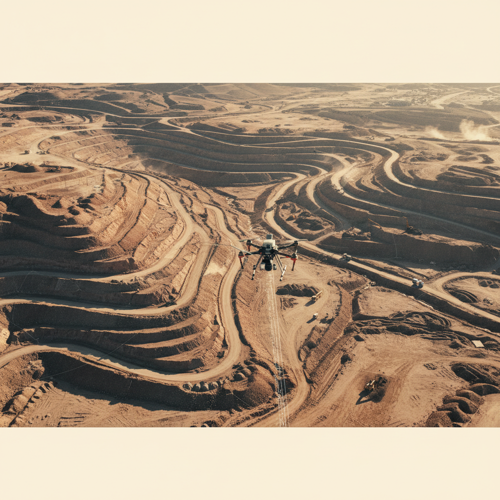
Megaprojects in the Kingdom — Vision 2030 cities, mining haul-road networks, hydrocarbon pipeline corridors — all need terrain models that survey teams, designers, and earthworks contractors can trust at design-level tolerance. Drone LiDAR delivers that fidelity at flight speed, removing the GPS-RTK base-and-rover bottleneck on large or hazardous sites.
We pair full-waveform LiDAR with calibrated photogrammetric imagery to produce co-registered point clouds, orthomosaics, and classified surface/terrain models. Ground control is placed where standards demand it; trajectory is post-processed against permanent reference stations.
Outputs ship in LAS/LAZ for point clouds, GeoTIFF for orthomosaics and rasters, and DXF/Shapefile for vectorised features — all stamped with full processing metadata.
Classified point cloud
Ground, vegetation, structures, and noise classes separated. Used downstream for DTM extraction and volumetric calculation.
Bare-earth model
GNSS-PPK trajectory → boresight calibration → strip adjustment → ground classification → surface/terrain modelling → contour generation → BIM/CAD export.
From flight plan to BIM-ready model.
Mission Design & GCPs
Block plan, overlap and altitude tuned to client accuracy spec. Ground control points placed and surveyed to PPK/RTK standard.
Airborne Capture
LiDAR + RGB flown along planned strips. Continuous PPK trajectory logging against permanent reference stations.
Trajectory & Strip Adjust
Post-processed PPK trajectory, boresight calibration, strip adjustment to GCPs. Absolute accuracy verified against check-points.
Classification & Deliverables
Point-cloud classification, DTM/DSM extraction, orthomosaic and contour generation. Exports to client-specified formats.
What you receive.
Classified point cloud
LAS/LAZ with ASPRS classes — ground, vegetation, buildings, noise.
DTM / DSM
Bare-earth and surface models at client-specified grid resolution.
Orthomosaic
GSD-controlled true-orthophoto with embedded geospatial reference.
Contour vectors
Major/minor contours, breaklines, spot heights — DXF / Shapefile.
Volumetric report
Cut/fill against client design surface with confidence bands.
Accuracy report + QA/QC log
Check-point residuals, GCP RMSE, full processing log + calibration records.
Where this service is deployed.
Capture your site.
Share your AOI, accuracy spec, and deliverable format. We respond with a survey plan, GCP layout, and schedule within 48 hours.