When a corridor route, tailings facility, wellfield, or mineral prospect must be assessed under schedule pressure, the real question is not whether data can be collected. It is whether the data can be collected fast enough, safely enough, and with sufficient technical traceability to support a defensible decision. That is where drone surveys vs ground crews becomes a procurement and project controls issue, not just a field methods debate.
For enterprise operators, EPC teams, and public-sector project owners, the comparison is rarely binary. Ground crews still have a place in geotechnical validation, spot checks, sampling, and localized inspection. But for wide-area mapping, repeatable condition monitoring, and access-limited terrain, drone-based survey platforms have changed the operating model. They compress mobilization time, reduce field exposure, and produce calibrated digital datasets that can be cross-validated and audited downstream.
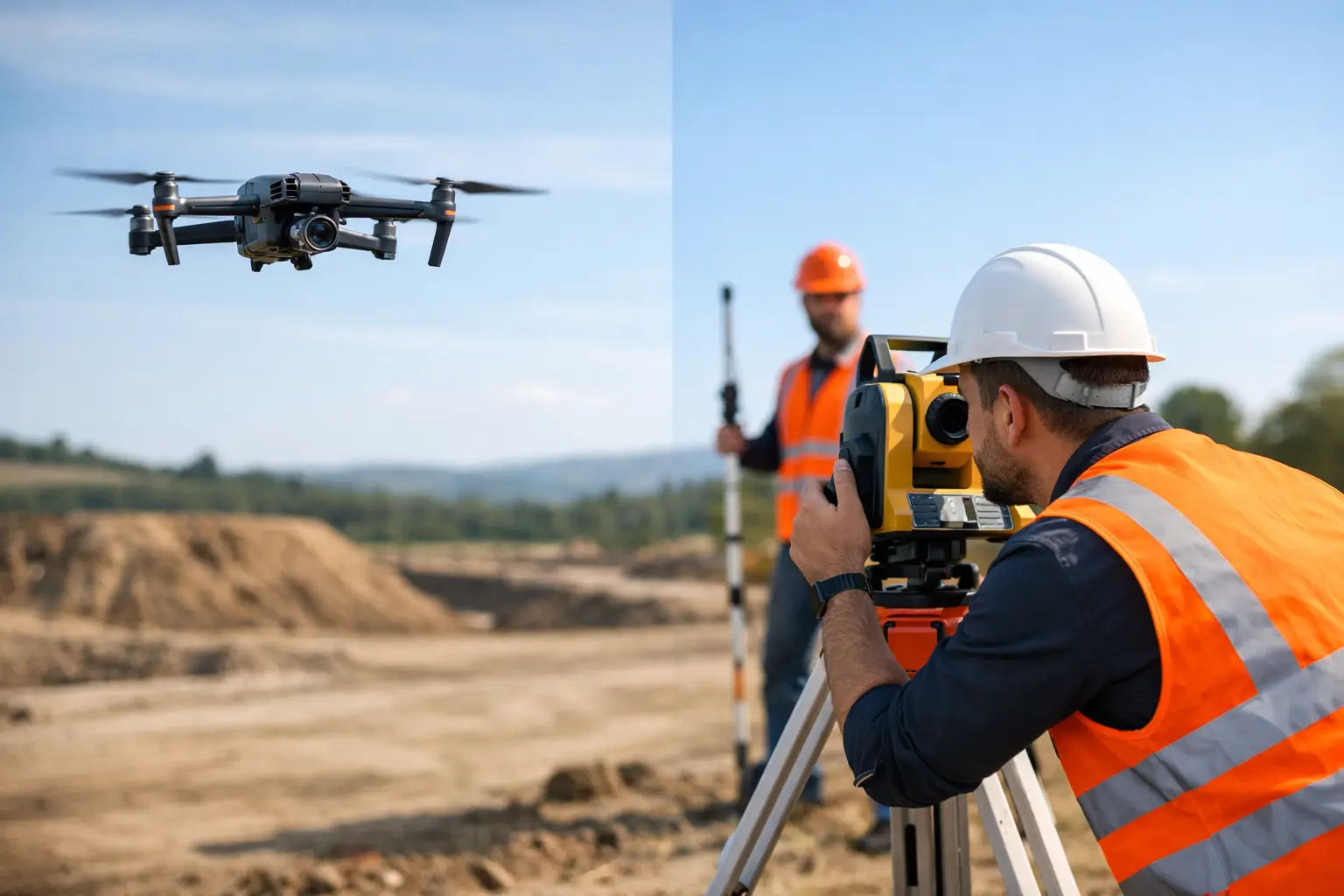
What changes when you compare drone surveys vs ground crews
The main difference is not simply that one method flies and the other walks. It is that each method creates a different field risk profile, a different data density profile, and a different project timeline.
Ground crews are inherently sequential. Coverage depends on where personnel can physically reach, how fast they can traverse the site, and what conditions allow safe access. In rocky terrain, active industrial zones, desert environments, flood-prone wadis, pipeline corridors, or restricted assets, productivity declines quickly. The result is often selective sampling rather than continuous spatial intelligence.
Drone surveys operate differently. A properly planned airborne mission captures continuous, georeferenced coverage across the target area using LiDAR, photogrammetry, magnetics, electromagnetic payloads, thermal, hyperspectral, or other sensor packages matched to the project objective. That changes the output from isolated observations to a structured geospatial dataset. For technical teams, that means better interpolation, better change detection, and fewer blind spots between field points.
This does not mean drones replace all field work. It means they shift field work toward validation and interpretation rather than manual coverage collection.
Speed and mobilization are usually the first break point
On industrial and infrastructure projects, delays are rarely caused by processing alone. They usually begin with access logistics, permitting coordination, transport of personnel and equipment, and the cumulative drag of manual site coverage.
Ground crews require larger field footprints. More personnel means more safety management, more vehicles, more route planning, and more exposure to heat, fatigue, traffic, and terrain hazards. On large or remote sites, even basic survey progress can be gated by daylight hours and travel time between control points.
A drone program can materially reduce that burden. Smaller field teams can mobilize quickly, establish control, execute acquisition, and move into processing with less disruption to site operations. In desert or remote conditions, that speed matters. It shortens the time between identifying a data requirement and generating interpreted outputs that engineering, exploration, or planning teams can use.
For decision-makers, the schedule benefit is not just about finishing the survey faster. It is about pulling forward downstream decisions such as route optimization, target ranking, volume calculation, hazard identification, or pre-construction planning.
Safety is not a soft benefit
In the comparison between drone surveys vs ground crews, safety is often treated as a secondary advantage. In practice, it is one of the strongest commercial arguments.
Ground-based surveys place personnel directly into the hazard environment. That may include unstable slopes, active plant areas, energized corridors, soft ground, open pits, confined spaces, desert heat, or unexploded legacy site conditions. Even with strong field procedures, risk exposure scales with time on site and distance traveled on foot or by vehicle.
Drone systems reduce that exposure by moving the sensor to the problem instead of moving people through it. This is especially valuable for stockpile measurement, highwall inspection, utility corridor review, tailings monitoring, flood impact assessment, and inaccessible terrain mapping. Fewer personnel in the hazard zone means fewer opportunities for incidents, and that is relevant to both HSE performance and project continuity.
The trade-off is that drone operations introduce a different control framework, including airspace compliance, flight planning, environmental limits, battery management, sensor calibration, and mission-specific QA/QC. For serious operators, those are manageable variables. They do not remove discipline from the process. They demand it.
Data quality depends on method fit, not hype
The strongest case for drone deployment is not that it is newer. It is that it can produce higher-resolution, spatially continuous, and fully auditable datasets when the mission is correctly designed.
Ground crews can generate highly accurate point measurements. In many cases, they remain essential for benchmark control, material sampling, hand-held geophysics, and direct condition verification. If the project only requires a small number of discrete observations, a ground crew may be the right answer.
However, once the requirement expands to full-surface modeling, terrain reconstruction, volumetrics, anomaly mapping, drainage analysis, or repeat monitoring, drones usually offer a superior data architecture. High-overlap imagery, dense point clouds, calibrated LiDAR returns, and synchronized multi-sensor acquisition can create a much more complete site model than manually collected spot data.
That said, quality is not automatic. A drone survey is only as defensible as its control network, calibration routine, environmental compensation, flight design, sensor integration, and processing workflow. Enterprise buyers should look beyond attractive visuals and ask whether the final deliverables are traceable, cross-validated, and suitable for engineering or geological use. The difference between a drone operator and a geospatial intelligence contractor is usually found in those details.
Cost is more nuanced than daily field rates
Many comparisons start with labor cost. That is too narrow for capital projects, regulated infrastructure, and resource development.
Ground crews may appear less expensive for very small sites or one-off tasks. But total cost escalates when a project requires repeated site visits, extended field duration, large teams, difficult access, or manual processing of fragmented observations. There is also the indirect cost of slower decision cycles, delayed engineering inputs, and higher exposure to safety incidents.
Drone surveys often reduce total project cost by compressing the acquisition window and increasing the amount of usable data captured in each mobilization. The value compounds when the same dataset supports multiple workstreams, such as topographic modeling, asset inspection, environmental baseline mapping, and progress tracking.
For buyers in mining, water, utilities, and major infrastructure, the better question is not which method is cheaper per day. It is which method produces decision-grade intelligence at the lowest total operational burden.
Where ground crews still make sense
A disciplined comparison should acknowledge where manual teams remain necessary. Ground crews are still critical when the objective requires direct contact with the site condition, physical sampling, staking, intrusive investigation, or instrument placement. They are also valuable in dense canopy, enclosed interiors without suitable flight access, and highly localized works where setup overhead would outweigh drone efficiency.
The most effective programs are often hybrid. A drone mission establishes wide-area situational awareness and identifies targets, anomalies, or change zones. A ground crew then validates specific features, collects physical measurements, or performs follow-up investigation. This approach is faster than relying on ground teams for initial coverage, and more defensible than relying on remote sensing without field verification.
What procurement teams should ask before choosing
Selection should be based on mission requirements, not technology preference. The first question is scale. If the area is large, linear, inaccessible, or requires repeat coverage, drone deployment usually has a structural advantage.
The second question is output. If the project requires interpreted geospatial intelligence, auditable models, and multi-layer analysis rather than raw observations, then the provider’s processing, QA/QC, and reporting capability matter as much as field acquisition.
The third question is operating environment. Harsh temperatures, remote access, active industrial risk, and schedule compression all favor methods that reduce human exposure while preserving data quality.
Finally, ask whether the provider understands the sector context. A mining target, a groundwater prospect, a utility corridor, and a megaproject construction package do not use the same survey logic, reporting structure, or validation criteria. Air Solutions, for example, positions drone acquisition as part of a broader interpreted geospatial workflow, which is the right model for buyers who need technical outputs that can stand up in planning, engineering, and investment review.
The best survey method is the one that reduces uncertainty without creating new operational drag. In many modern field environments, that means using drones for coverage, speed, and exposure reduction, then using ground crews where direct verification adds real value. Buyers who frame the choice that way tend to get better data, cleaner execution, and fewer surprises once the real project decisions begin.