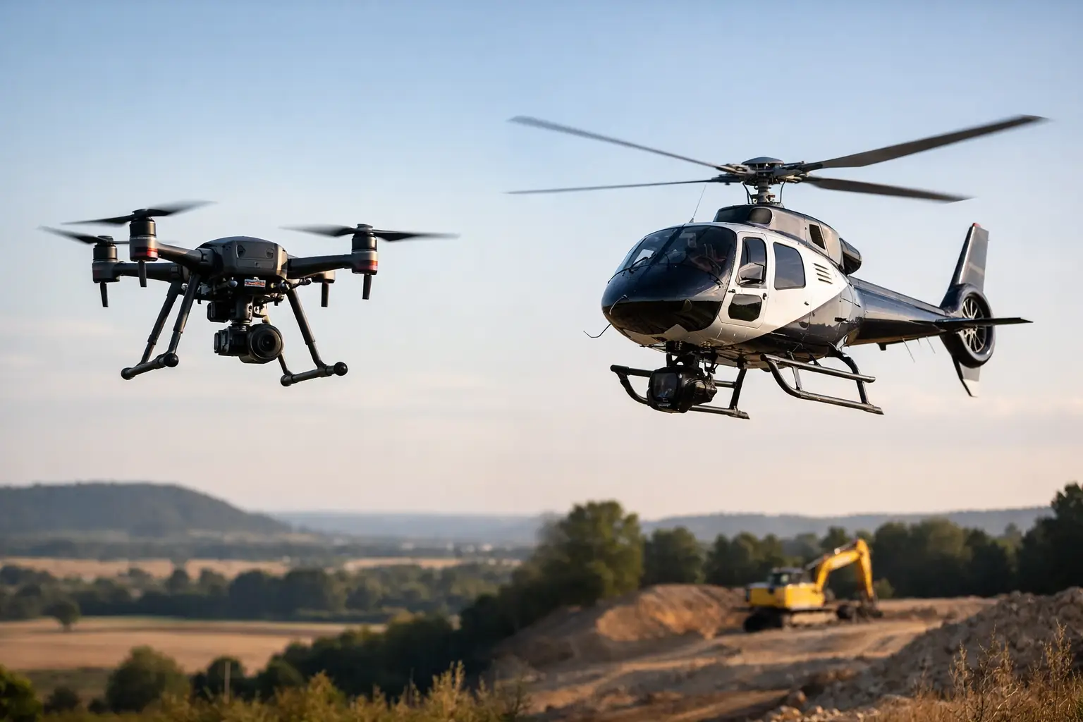
A helicopter can still cover a vast corridor in a single campaign, but scale alone no longer decides the best survey platform. For mining, water, energy, and infrastructure operators, the real question in drone surveys versus helicopters is which system delivers decision-grade data faster, safer, and with tighter operational control for the specific asset, terrain, and sensor package involved.
Where drone surveys versus helicopters actually differ
The difference is not simply unmanned aircraft versus manned aircraft. It is a difference in operating model, data density, mobilization logic, and project economics.
Helicopters were historically the practical choice when survey blocks were large, logistics were difficult, and sensor payloads demanded a stable airborne platform with long endurance. That remains true in certain regional programs, especially where thousands of line-kilometers must be acquired continuously over remote ground. Yet that legacy advantage narrows when buyers evaluate the full chain - permitting, crew safety, standby costs, weather windows, calibration discipline, and the time required to convert raw measurements into auditable technical outputs.
Drone platforms changed the economics because they can be mobilized quickly, flown low and slow with high positional control, and configured around a narrower but more repeatable mission envelope. For industrial buyers, that often matters more than pure daily coverage. A survey that reaches the site faster, acquires higher-resolution data, and reduces exposure around difficult terrain may create more value than a larger campaign flown at higher altitude.
Cost is not just hourly aircraft rate
Helicopters look efficient when measured by area covered per day. That metric is incomplete. Institutional buyers should assess total delivered cost per usable dataset.
A helicopter campaign carries aircraft charter cost, pilot and crew cost, fuel logistics, mobilization complexity, and the indirect cost of operating in limited windows. If the survey requires repeat flights because of line deviation, turbulence, inaccessible low-altitude segments, or inconsistent data quality, the apparent productivity advantage can erode quickly.
Drone operations usually start from a lower mobilization base. The field footprint is smaller, fuel dependency is reduced or eliminated, and staging requirements are lighter. For targeted blocks, stockpiles, pits, dams, utility corridors, tailings facilities, wadis, and localized geophysical targets, this often produces a more efficient commercial model. The cost benefit becomes even clearer when the assignment involves repeat monitoring rather than a one-time regional sweep.
That said, helicopters still retain an edge on very large, continuous areas where line production is the dominant economic driver and airspace access is straightforward. The right procurement decision depends on campaign geometry, not on aircraft preference.
Resolution, altitude, and why lower often wins
For many survey objectives, data quality improves when the platform can fly closer to the surface with stable line spacing and predictable speed. That is where drones are especially effective.
Lower flight altitude can materially improve magnetic anomaly definition, topographic detail, photogrammetric accuracy, and LiDAR point density. The practical result is sharper subsurface interpretation, tighter structural mapping, better change detection, and more reliable engineering inputs. In complex desert terrain, escarpments, infrastructure corridors, and confined industrial footprints, this level of control is difficult to match consistently from a helicopter.
Helicopters can carry larger payloads and may support sensor combinations that exceed the lift capacity of smaller UAV systems. But payload capacity is only one side of the equation. If the project benefits from dense, repeatable measurements over a constrained area, a calibrated drone platform may generate a more useful dataset for design, exploration targeting, or asset integrity assessment.
This is particularly relevant when clients require interpreted outputs rather than raw files. Higher-resolution acquisition upstream usually improves downstream interpretation, provided the workflow includes disciplined QA/QC, georeferencing control, and cross-validation.
Safety margins change when crews leave the aircraft
For mission-critical operators, safety is not a soft consideration. It is a procurement criterion.
Low-altitude helicopter work introduces crewed flight exposure in environments that may include transmission assets, rugged relief, dust, extreme heat, and variable wind conditions. These risks are managed professionally in manned aviation, but they cannot be ignored, particularly on repeated low-level passes.
Drone deployment changes that risk profile. The crew remains on the ground, flight lines can be adjusted with less operational friction, and inaccessible or hazardous zones can be surveyed without placing personnel in the aircraft over the target. This is a major advantage around tailings storage facilities, highwall faces, pipeline corridors, flood channels, and industrial assets with restricted approach conditions.
For buyers operating under strict HSE governance, that difference carries practical weight. Reduced airborne human exposure can simplify internal approvals and improve operational resilience during difficult field programs.
Mobilization speed matters more than many tenders recognize
In exploration, water resource assessment, and infrastructure planning, delayed data is often expensive data. A platform that can mobilize quickly and start producing calibrated outputs with less logistical drag can alter project timelines.
Helicopter campaigns usually require broader coordination - aircraft scheduling, fuel support, crew planning, landing arrangements, and weather-dependent operating sequences. This is manageable on major programs, but it can slow response times.
Drone systems are generally more agile. They can be deployed for pilot surveys, validation blocks, urgent re-fly requirements, and phased acquisition strategies without the same overhead. That flexibility is valuable when a client needs to test a target before expanding scope, revisit an anomaly after interpretation, or acquire seasonal comparison data.
In Saudi and Gulf operating conditions, where heat, remoteness, and compressed project schedules are common, fast mobilization is not a convenience. It is a performance variable.
Drone surveys versus helicopters in harsh environments
Desert operations expose every platform to the same fundamentals - heat loading, dust ingress, visibility issues, and difficult access. The difference lies in how those conditions affect mission continuity and data repeatability.
Helicopters are powerful and versatile, but they depend on a larger support architecture. Dusty landing zones, remote fueling, and standby conditions can complicate execution. Drones face their own constraints, especially with battery management, wind tolerance, and payload limitations, but they can often be staged closer to the survey area with less infrastructure.
The practical question is not which platform is universally stronger in harsh conditions. It is which platform remains controlled and economically rational for the exact mission profile. For smaller to mid-scale blocks and technically demanding site work, drones often provide better operational discipline. For expansive regional programs, helicopters may still be justified.
Data governance and auditability are often the deciding factor
Enterprise buyers rarely purchase flight time. They purchase defensible information.
That shifts the evaluation away from aircraft type alone and toward the integrity of the acquisition and processing chain. Was the sensor calibrated correctly? Were flight lines executed to tolerance? Are positional records traceable? Were corrections applied consistently? Can the final interpretation be audited back to field procedures?
This is where specialized drone survey providers have established a strong advantage. A disciplined UAV workflow can be highly standardized, with documented pre-flight checks, sensor validation, telemetry logging, line monitoring, and post-processing controls. When combined with multi-sensor fusion and sector-specific reporting, the output becomes more actionable for technical and executive stakeholders.
A helicopter can also support excellent data quality in the hands of a strong operator. But the market no longer rewards aircraft size by default. It rewards calibrated, repeatable, and decision-ready deliverables.
When helicopters still make sense
There are cases where a helicopter remains the correct tool. If a client needs very broad regional coverage, long uninterrupted sorties, or a heavy sensor payload over large distances, manned aircraft can still be commercially sound. The same applies where regulatory conditions, communications range, or terrain continuity favor a conventional aviation model.
Buyers should be cautious about oversimplified claims that drones replace helicopters in every scenario. They do not. The strongest technical programs start by matching platform capability to survey objective, line-kilometer requirement, target resolution, and reporting standard.
What sophisticated buyers should ask before choosing
The best procurement discussions move quickly past platform branding and into technical controls. Ask what altitude and line spacing are achievable over the specific terrain. Ask how repeat flights are handled, how positional accuracy is validated, and what QA/QC evidence is delivered with the final package. Ask whether the contractor provides interpreted geoscience products or only raw sensor outputs.
That last point matters. A lower-cost flight campaign is not necessarily lower-cost if your internal team must absorb processing, validation, and interpretation risk afterward. Many organizations now prefer partners that deliver a fully auditable intelligence product rather than just airborne acquisition. That shift is one reason firms such as Air Solutions are gaining traction on high-value industrial programs.
The most effective platform is the one that reduces uncertainty at the point where capital, engineering, or regulatory decisions are made. If that requires scale over vast terrain, helicopters may still be justified. If it requires higher resolution, faster mobilization, safer low-altitude work, and tighter QA/QC control, drones are increasingly the better instrument. The smart decision is not to follow aviation tradition. It is to specify the survey outcome first, then select the aircraft that can prove it.