A greenfield target rarely fails because there was no data. It fails because the data was not discriminating enough to narrow the search area before time, capital, and drilling meters were committed. That is exactly where how radiometric data guides exploration becomes commercially relevant. When acquired, corrected, and interpreted properly, radiometric surveying helps teams separate background geology from alteration, map regolith behavior, and prioritize targets with a much tighter line of sight to field validation.
Why radiometric data matters early in the exploration cycle
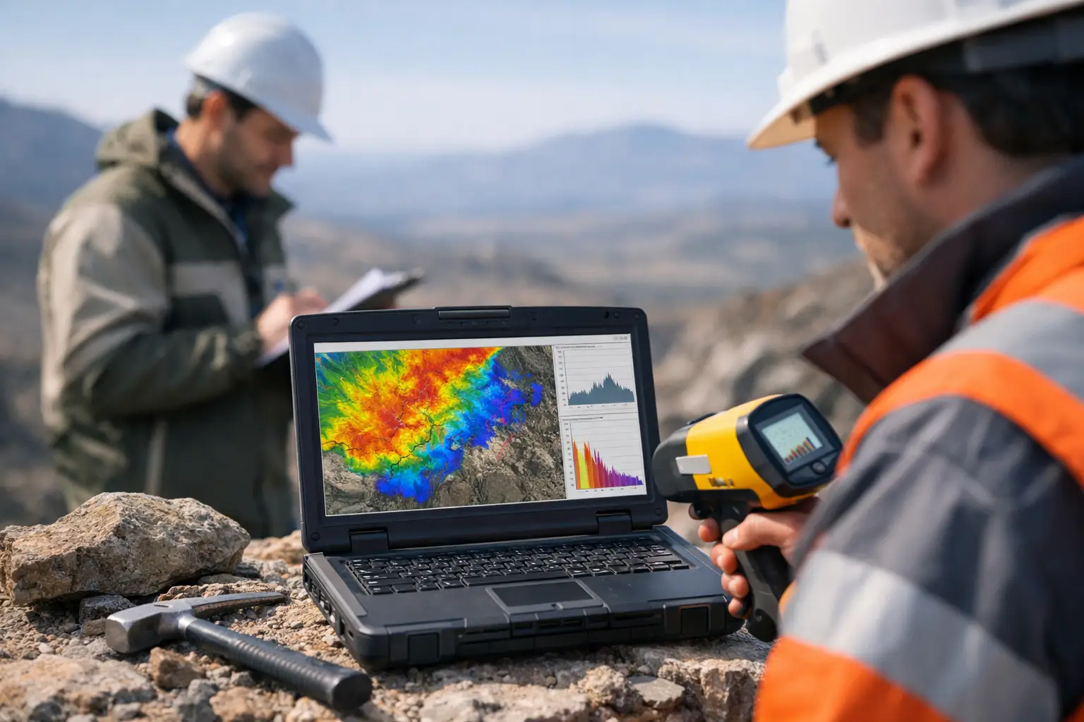
Radiometric surveys measure the natural gamma radiation emitted from near-surface concentrations of potassium, uranium, and thorium. Those three elements do not provide a direct image of ore at depth. What they provide is something equally valuable in early-stage decision-making: a calibrated picture of surface and near-surface geochemistry that can be cross-referenced against structure, lithology, weathering, and alteration.
For exploration managers, that distinction matters. Radiometric data is not a stand-alone targeting tool. It is a high-value layer in a broader geoscience workflow. Used in isolation, it can overstate significance in transported cover or culturally disturbed ground. Used with magnetics, topography, field mapping, and geologic context, it often reveals patterns that materially improve target ranking.
In arid terrains, where surface exposure may be better and vegetation masking lower, radiometrics can be especially effective. That does not remove the need for controls. Survey altitude, detector volume, calibration quality, moisture conditions, and terrain corrections all affect usability. Decision-grade outcomes depend on disciplined acquisition and traceable processing, not on the sensor alone.
How radiometric data guides exploration target generation
At the practical level, radiometric interpretation starts by converting gamma measurements into concentrations or equivalent concentrations of potassium, uranium, and thorium, then examining both the individual channels and the ratios between them. The value is often in the relationships. Potassium enrichment may indicate alteration associated with hydrothermal systems. Thorium can help distinguish lithologic units because it is typically less mobile. Uranium behavior can be more complex, sometimes highlighting redox processes, secondary dispersion, or localized accumulations.
Those signatures become more useful when interpreted spatially. A broad potassium high might have limited meaning on its own. A potassium anomaly aligned with structure, coincident with a magnetic break, and bounded by a mapped intrusive contact is a different proposition. That kind of integration helps geologists move from anomaly collection to anomaly qualification.
Radiometrics also helps reduce wasted field effort. Instead of treating a ten-kilometer corridor as uniformly prospective, teams can isolate the sectors where geochemical response, structural architecture, and surface expression align. That improves traversing efficiency, sampling density allocation, trench planning, and eventually drill collar placement. The commercial effect is straightforward: fewer low-probability decisions made on incomplete spatial evidence.
Mapping lithology and regolith response
One of radiometrics' most consistent applications is lithologic discrimination. Different rock types often carry distinct concentrations of potassium, uranium, and thorium, and those contrasts can remain detectable even when outcrop continuity is poor. In reconnaissance programs, this can sharpen geologic mapping quickly, especially where access is limited or where existing maps are too generalized for investment decisions.
Regolith adds complexity, but it also creates opportunity. In deeply weathered or partially transported terrains, radiometric response can indicate where surface material is residual and where it is masking the bedrock story. That distinction influences how much confidence an exploration team should place in soil geochemistry, surface mapping, and shallow trench results. It also affects where supplementary methods are needed before committing to expensive follow-up.
Recognizing alteration patterns
Hydrothermal alteration can redistribute potassium and, in some settings, affect uranium behavior. That makes radiometrics useful in porphyry, epithermal, and structurally controlled systems where alteration halos matter as much as obvious mineralization indicators. Ratio imaging, ternary composites, and filtered products can highlight subtle zones that are easy to miss in conventional field mapping.
There is a trade-off here. Surface alteration signatures do not always project simply to depth. Weathering can enhance or obscure radiometric expression, and some alteration systems have weak or ambiguous gamma signatures. A disciplined interpreter treats radiometric anomalies as hypotheses to test, not as proof.
The operational factors that determine data quality
Good interpretation starts with good acquisition. Radiometric systems are highly sensitive to flying height because gamma rays attenuate rapidly in air. Small altitude variations can create large amplitude differences if not measured and corrected accurately. The same is true for aircraft speed stability, detector configuration, line spacing, and spectral calibration.
Environmental effects are equally important. Soil moisture suppresses gamma response. Atmospheric radon can contaminate uranium channel measurements. Topography changes the geometry between detector and ground. Cultural features, surface disturbance, and infrastructure can introduce artifacts. In harsh operating environments, those variables need active management rather than post-survey explanation.
This is where drone-based deployment can offer a material advantage in selected programs. Lower-altitude operations, tight terrain following, rapid mobilization, and repeatable survey control can improve spatial resolution and shorten acquisition cycles, particularly across smaller, high-priority blocks or difficult access zones. The key qualifier is project fit. Large regional campaigns may still favor other platforms depending on coverage, budget, and airspace constraints. The right platform is the one that meets the geologic objective, QA/QC threshold, and timeline with the lowest execution risk.
How radiometric data guides exploration when fused with other datasets
Radiometrics becomes substantially more powerful when it is fused with complementary geophysical and geospatial layers. Magnetic data can map structure, intrusive bodies, and basement architecture. Electromagnetics can test conductivity contrasts related to alteration, groundwater, or mineralization. LiDAR and photogrammetry can constrain terrain, drainage, and lineament analysis. Hyperspectral data can extend mineralogical interpretation at the surface.
The integrated model is where enterprise value is created. A uranium-thorium ratio anomaly may indicate a lithologic contact, but if that contact also tracks a magnetic lineament and coincides with mapped alteration from spectral data, the target moves up the queue. If the radiometric anomaly sits in transported cover with no structural support and no corroboration from adjacent datasets, it may drop out before expensive ground work begins.
For institutional buyers and technical procurement teams, this matters because interpreted outputs are more useful than isolated grids. A decision-maker does not need three disconnected datasets and a stack of image products. They need a traceable interpretation showing which targets are supported, which are ambiguous, and which should be deferred. That reduces technical debate at the wrong stage of the program and improves capital discipline.
Common interpretation errors
The most common mistake is treating radiometric highs as direct mineral indicators. In reality, elevated counts often reflect lithology, weathering, or surficial concentration processes rather than economic mineralization. Another common error is ignoring the depth limitation of the method. Radiometrics responds to the uppermost part of the ground, typically only the top few tens of centimeters, depending on material and conditions. It is a surface-sensitive method by design.
A third error is underestimating processing rigor. Channel stripping, height normalization, radon correction, background removal, leveling, and calibration are not administrative details. They determine whether the final products are interpretable or misleading. Any exploration program using radiometric data for target ranking should expect documented QA/QC, processing lineage, and auditable deliverables.
Where radiometrics delivers the most value
Radiometric surveying delivers the strongest return where exploration teams need rapid surface discrimination over broad or logistically difficult areas, where lithologic and alteration mapping can materially reduce uncertainty, and where the data can be fused into a multi-sensor targeting framework. It is particularly effective in early-stage screening, target refinement, regolith assessment, and geologic map improvement.
It is less decisive where thick transported cover masks the near surface, where cultural radiation sources distort readings, or where teams expect a direct proxy for deep ore. In those cases, radiometrics still has a role, but usually as a supporting layer rather than the lead dataset.
For technically mature programs, the question is not whether radiometric data can produce anomalies. It can. The real question is whether the survey design, calibration protocol, and interpretation workflow are strong enough to convert those anomalies into defensible exploration decisions. That is the threshold that separates attractive imagery from useful intelligence.
Air Solutions approaches radiometric mapping in that operational context - as one calibrated input in a multi-sensor, audit-traceable exploration workflow designed to reduce uncertainty before field spend escalates.
The best exploration programs are rarely the ones with the most data. They are the ones where each dataset has a defined job, known limitations, and a clear path into action. Radiometric surveying earns its place when it helps teams say no to weak ground earlier and move faster on the targets that stand up under scrutiny.