A basin can look quiet at surface level and still be signaling active petroleum migration. That is where oil seep detection hyperspectral imaging becomes operationally valuable. Instead of relying on sparse ground observations or broad visual interpretation, it measures narrow spectral responses tied to hydrocarbons, alteration minerals, moisture effects, and stressed vegetation, then turns those responses into mapped targets that can be reviewed, cross-validated, and prioritized.
For exploration teams, the appeal is not novelty. It is decision speed with defensible evidence. In frontier areas, mature basins with subtle leakage, or environmentally sensitive corridors, hyperspectral data can narrow field programs, improve prospect ranking, and reduce wasted mobilization. The method is especially useful when clients need rapid screening over large blocks without waiting for a full conventional campaign to mature.
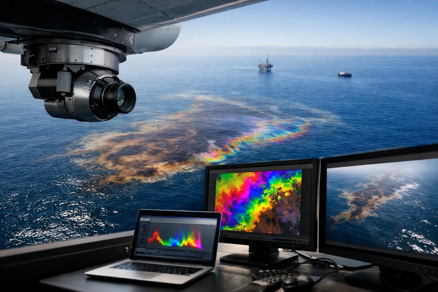
What oil seep detection hyperspectral imaging actually measures
Hyperspectral imaging captures reflectance across a dense sequence of narrow spectral bands. That matters because hydrocarbon seepage rarely appears as a single visual feature. More often, it produces a set of indirect and direct indicators across the landscape.
Direct indicators may include spectral absorption features associated with hydrocarbons or bituminous materials at surface. Indirect indicators often carry equal weight. These include ferric and ferrous iron changes, clay mineral alteration, carbonate responses, sulfate formation, bleaching patterns, and vegetation stress caused by long-term microseepage. In practical survey design, the strongest interpretation usually comes from pattern association rather than any one spectral anomaly alone.
This is also where technical discipline matters. Raw hyperspectral imagery does not identify a seep by itself. The value comes from atmospheric correction, radiometric calibration, georeferencing, spectral unmixing, noise suppression, and interpretation against known geology. Without that chain, anomaly maps are easy to overstate.
Why the method matters in exploration screening
Traditional seep investigation can be effective, but it is often slow, discontinuous, and expensive to scale. Ground traverses cover only a fraction of a concession. Satellite products may lack the spatial detail or acquisition control needed for subtle targets. Manned-aircraft campaigns can deliver quality data but may not fit the economics or mobilization profile of smaller or time-sensitive programs.
Oil seep detection hyperspectral imaging sits in a useful middle ground. It can screen broad areas quickly while preserving the spectral resolution needed to separate hydrocarbon-related responses from background lithology. For exploration managers, that translates into better target triage. For procurement teams, it means a survey package that can be planned, executed, and audited within a defined technical scope.
The strongest use case is early-stage derisking. A calibrated hyperspectral survey can help determine where follow-up geochemistry, structural mapping, soil gas analysis, or geophysics should be concentrated. It does not replace subsurface methods. It helps ensure they are deployed in the right places.
Where hyperspectral seep detection works well and where it does not
Performance depends heavily on surface conditions. Arid and semi-arid terrains are often favorable because exposed soils and limited vegetation reduce spectral masking. That makes parts of the Gulf region operationally attractive for airborne hyperspectral work, provided acquisition is managed around dust, sun angle, and thermal conditions.
By contrast, dense vegetation, standing water, urban cover, and fresh alluvium can suppress or distort seep-related signals. Weathered surfaces may also complicate interpretation if alteration products are widespread for reasons unrelated to hydrocarbons. Carbonate terrains, evaporitic settings, and iron-rich regolith can all produce false positives if geology is not integrated from the start.
That is why the method should be treated as a probabilistic screening tool, not a standalone proof of petroleum charge. In some concessions, hyperspectral mapping will sharply improve target confidence. In others, it will mostly rule out areas that do not justify additional spend. Both outcomes have value.
Acquisition quality determines whether the output is useful
The commercial mistake is to think the sensor alone carries the project. It does not. Survey altitude, ground sample distance, spectral calibration, flight line overlap, solar geometry, atmospheric state, and reference panel control all influence the reliability of the final interpretation.
In operational terms, airborne collection must be tightly managed. Desert environments introduce glare, haze, heat shimmer, and dust loading that can degrade signal quality if not accounted for in mission planning. Platform stability also matters, particularly when clients want repeatable outputs that can be compared against legacy datasets or integrated with other airborne products.
A disciplined provider will document acquisition conditions, calibration routines, processing steps, and classification logic so the final map is fully traceable. That level of QA/QC is not administrative overhead. It is what separates a visually interesting image from a decision-grade technical deliverable.
Interpreting seep indicators requires geoscience context
A spectral anomaly is only the start of the analysis. The real question is whether that anomaly is geologically coherent. Does it align with faulting, fractures, anticlines, seep-prone stratigraphy, caprock breaches, or known migration pathways? Does it persist across multiple indicators, or is it isolated to a single mineral response that could have another explanation?
Strong interpretation combines hyperspectral outputs with structural mapping, topography, drainage, geochemistry, and where available, magnetic or electromagnetic context. This multi-sensor view is especially useful in areas where seep expression is subtle. An alteration halo near a fault corridor has a different meaning than the same halo on a disturbed construction surface or saline flat.
For enterprise buyers, this is where service design matters. Many clients do not need a stack of sensor rasters. They need interpreted prospectivity layers, confidence-ranked anomalies, and reporting that stands up in technical committee review. That is the difference between data acquisition and geospatial intelligence.
Drone deployment changes the economics of local-scale seep mapping
For broad regional screening, fixed-wing aircraft and some satellite programs still have a role. But for focused blocks, inaccessible terrain, pipeline corridors, and rapid follow-up over prioritized targets, drone-based acquisition can materially improve responsiveness.
A well-configured UAV survey can be mobilized faster, flown lower, and tasked more selectively than many conventional platforms. That improves spatial detail and often reduces the cost of investigating specific anomalies. It also lowers exposure for field crews in remote or environmentally difficult locations. In high-value industrial settings, those advantages are operational, not cosmetic.
This is particularly relevant when seep mapping is part of a larger technical package. A contractor such as Air Solutions can align hyperspectral data with LiDAR, photogrammetry, magnetic data, or utility constraints, then deliver interpreted outputs under one QA/QC framework. For owners and agencies, that means fewer data handoff issues and clearer accountability.
Common failure points in oil seep detection hyperspectral imaging
Most weak results can be traced to one of three issues. The first is overclaiming spectral certainty. Hydrocarbon-related responses are real, but many are indirect, and they must be separated from non-petroleum causes through geological control.
The second is poor calibration and processing discipline. If atmospheric correction is unstable or field references are inadequate, subtle absorption features can be distorted beyond practical use. In seep studies, those subtleties often carry the signal.
The third is treating the survey as an isolated deliverable. The best results come when hyperspectral acquisition is commissioned with a clear downstream plan - field verification, geochemical sampling, structural follow-up, or integration into basin screening. Without that, anomaly maps may be technically correct but commercially underused.
What buyers should expect from a decision-grade deliverable
A credible seep detection program should produce more than imagery and generalized commentary. Buyers should expect mapped anomalies with classification logic, acquisition metadata, calibration records, processing notes, confidence statements, and interpretation tied to known geological controls. If the outputs are intended for investment, permitting, or exploration planning, auditability matters.
The final reporting should also be clear about limits. Not every anomaly is a seep. Not every seep signals commercial accumulation. A disciplined interpretation states where confidence is high, where uncertainty remains, and what follow-up work is justified. That transparency improves planning and protects the technical case when results move up to executive review.
Oil seep detection hyperspectral imaging is most valuable when it is treated as a precision screening instrument inside a larger exploration system. Used that way, it can shorten the path from broad acreage to credible targets, while keeping the evidence chain clear enough to support real capital decisions.