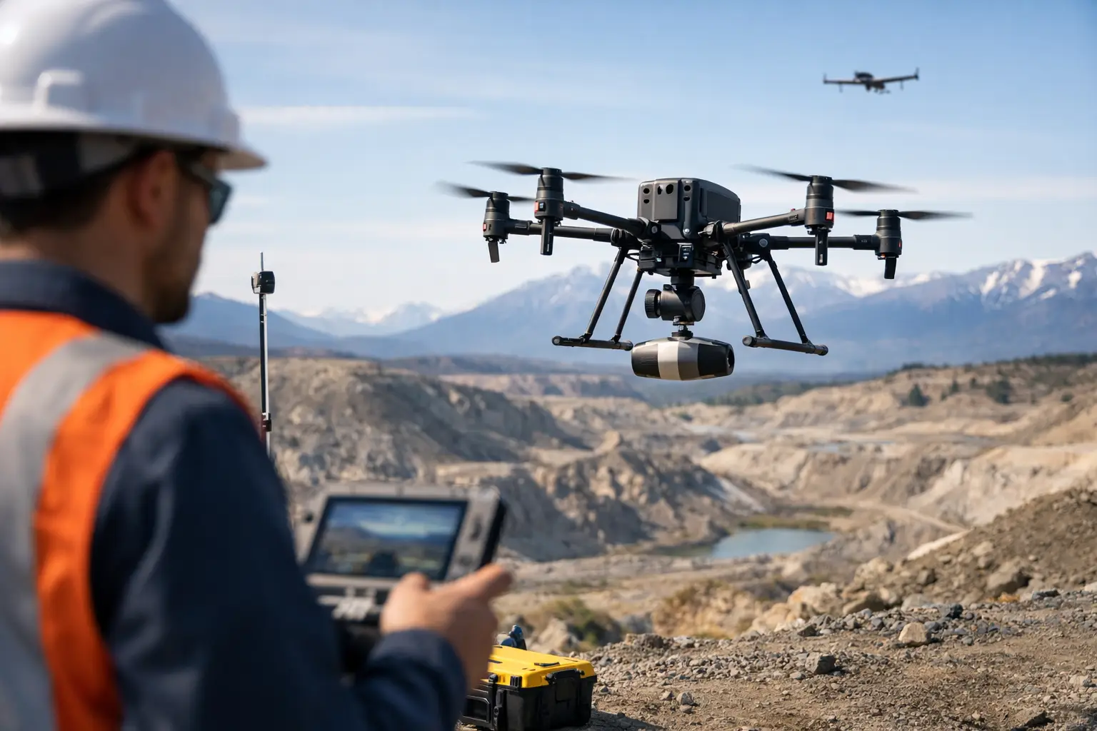
A decade ago, drone geophysics was often treated as a niche alternative - useful for pilot projects, difficult terrain, or sites too small to justify manned aircraft. That position is no longer defensible. The future of drone geophysics is being shaped by a different expectation: enterprise buyers now want survey systems that mobilize quickly, operate safely in constrained environments, and produce interpreted, decision-grade outputs with traceable QA/QC.
For mining, water, utilities, and infrastructure programs, the question is not whether drones can collect geophysical data. The question is where drone-based methods now outperform legacy approaches, and how quickly procurement models, technical standards, and project design will adjust.
What will define the future of drone geophysics
The next phase will not be driven by airframes alone. It will be defined by the maturity of the full operating stack: calibrated sensors, stable flight control, repeatable acquisition parameters, environmental compensation, processing discipline, and interpretation workflows that connect geophysical anomalies to engineering or exploration decisions.
That matters because raw data volume is no longer the constraint. The real differentiator is confidence. Buyers need to know whether an aeromagnetic response can be trusted near infrastructure, whether an electromagnetic result has been corrected for platform noise, and whether a multi-sensor survey can be defended in board review, permitting, or technical due diligence.
In practical terms, the market is moving away from drone surveys as isolated flight operations and toward drone geophysics as an auditable intelligence service. That shift favors operators who can document calibration, validate data quality, and deliver integrated interpretation rather than sensor files alone.
From single-sensor flights to fused subsurface intelligence
One of the clearest changes ahead is the decline of the single-sensor mindset. Magnetic data remains highly valuable, particularly for structural mapping, lithological discrimination, and targeting. But many project owners no longer want one dataset at a time. They want correlation between magnetic, electromagnetic, LiDAR, photogrammetric, radiometric, and hyperspectral information where the geology and project economics justify it.
This is where the future of drone geophysics becomes more strategic. A magnetic anomaly by itself can be interesting. A magnetic anomaly aligned with topographic controls, mapped lineaments, altered surface mineralogy, and known groundwater pathways is far more actionable. For infrastructure planners, the same principle applies. Utility risk, ground condition, drainage behavior, and terrain constraints are rarely solved by one sensing modality.
Multi-sensor fusion is not simply a product expansion exercise. It changes how surveys are scoped. Instead of commissioning separate campaigns with separate mobilizations and separate reporting chains, buyers can increasingly structure work around a unified acquisition and interpretation program. That reduces schedule friction and improves data alignment across teams.
The trade-off is complexity. Fused datasets require stronger synchronization, tighter QA/QC, and more disciplined geospatial registration. Poorly integrated multi-sensor work can create false confidence faster than a single-sensor survey can. The providers that lead this market will be the ones that treat data fusion as a controlled technical process, not a marketing phrase.
Smaller systems, better sensors, tighter tolerances
Sensor miniaturization will continue, but the more important development is performance consistency at lower size, weight, and power thresholds. As payloads become lighter and more power efficient, operators can fly longer lines, use smaller platforms in constrained environments, and deploy with less logistical overhead. That improves commercial viability for remote prospects, linear corridors, and phased investigation programs.
At the same time, tolerances will become less forgiving. As clients become familiar with drone geophysics, they will ask harder questions about heading effects, altitude control, line spacing, sampling frequency, noise floors, and repeatability. A lower-cost platform does not automatically create a lower-cost project if the data quality requires reflight or limits interpretation.
This is especially relevant in desert and high-temperature operating environments. Thermal loading, wind variability, dust exposure, and magnetic contamination risk all affect survey reliability. The future belongs to operators that can sustain calibrated performance in those conditions, not just complete a flight plan.
Regulatory maturity will expand the addressable market
Regulation is often treated as an external constraint, but it is also a market maker. As aviation authorities formalize beyond-visual-line-of-sight frameworks, corridor operations, and industrial drone permissions, larger geophysical programs become commercially realistic. This is particularly important for mining districts, pipeline routes, utility corridors, groundwater campaigns, and national infrastructure planning.
More mature regulation will allow drone geophysics to move beyond short-duration site surveys into repeatable regional programs. That does not mean drones will replace every manned-aircraft survey. Large-area reconnaissance still favors fixed-wing manned platforms in many cases, especially where scale and transit efficiency dominate. But the boundary will keep shifting.
The winning procurement model will likely be hybrid. Manned aircraft may remain efficient for broad regional screening, while drones take over infill work, target refinement, engineering support, and repeat monitoring. For many asset owners, that blend will deliver the best balance of coverage, resolution, safety, and budget control.
Data products will matter more than flight hours
Another major shift is commercial rather than technical. Buyers are becoming less interested in the mechanics of collection and more interested in the reliability of the final deliverable. That means interpreted geoscience products, anomaly maps, 3D models, cross-validated subsurface targets, and reporting packages aligned to investment or engineering decisions.
This is a significant change in the future of drone geophysics. As the market matures, pricing pressure will move away from simple flight-hour comparisons and toward output quality, turnaround time, and auditability. A provider that delivers clean, calibrated, traceable interpretation with a clear decision pathway will be more valuable than one that simply flies more lines at a lower rate.
For technical procurement teams, this will sharpen vendor evaluation. Questions will increasingly focus on processing controls, line leveling methodology, georeferencing integrity, uncertainty management, and whether the supplier can translate geophysical signatures into sector-specific recommendations. In mining, that may mean structural targeting and drill planning support. In water, it may mean salinity mapping, fracture tracing, or aquifer boundary interpretation. In infrastructure, it may mean utility conflict avoidance and geohazard screening.
Automation will improve speed, but not replace geoscientific judgment
Autonomous mission planning, adaptive terrain following, cloud processing, and machine-assisted anomaly detection are all advancing quickly. These tools will improve turnaround and reduce repetitive processing work. They will also make repeat surveys more standardized across large programs.
Still, geophysics does not become reliable just because a workflow is automated. Automated classification can misread cultural noise. Machine learning can overfit local patterns. Even well-trained models depend on representative training data, correct preprocessing, and experienced review.
That is why expert interpretation remains central. The market will reward teams that combine automation with domain control - geophysicists, GIS specialists, and field operators working within documented acquisition and validation procedures. In high-value industrial settings, judgment is not optional. It is part of the deliverable.
Sector demand will shape adoption more than technology headlines
Not every industry will adopt at the same pace. Mining will remain a major growth driver because drone geophysics fits early-stage target generation, brownfield extension work, and rapid follow-up over difficult terrain. Water resource development is also likely to expand, particularly where groundwater exploration requires fast, lower-impact reconnaissance across broad areas.
Utilities and infrastructure will become increasingly important as asset owners seek non-intrusive methods to de-risk construction corridors, detect buried features, and monitor ground conditions around major works. Oil and gas operators may apply drone geophysics selectively where access restrictions, safety constraints, or inspection economics favor unmanned deployment.
In Gulf markets, adoption will be shaped by heat tolerance, operational discipline, and alignment with national development programs. Providers that can execute in harsh environments while maintaining fully auditable technical standards will have a clear advantage. That is one reason companies such as Air Solutions are positioning drone geophysics not as a novelty, but as part of a broader geospatial intelligence capability tied to mining, water, energy, and strategic infrastructure delivery.
What buyers should expect over the next five years
Over the next five years, clients should expect denser datasets, faster mobilization, more integrated reporting, and wider acceptance of drone-acquired geophysical data in formal project workflows. They should also expect greater scrutiny. As the market grows, weak operators will be exposed by inconsistent calibration, poor processing discipline, and generic reporting that does not survive technical review.
The smartest buyers will not ask whether a drone can carry a sensor. They will ask whether the survey design matches the target depth, whether interference sources have been modeled, whether the dataset is cross-validated, and whether the final interpretation is fit for investment, engineering, or regulatory use. Those questions will separate experimental deployments from decision-grade programs.
The future of drone geophysics is not a story about replacing one aircraft with another. It is about compressing the path from field acquisition to defensible action. When that path is calibrated, traceable, and operationally controlled, drone geophysics stops being an emerging option and becomes standard infrastructure for serious subsurface intelligence.
The organizations that move early, with disciplined specifications and the right technical partner, will make better decisions before the rest of the market catches up.