
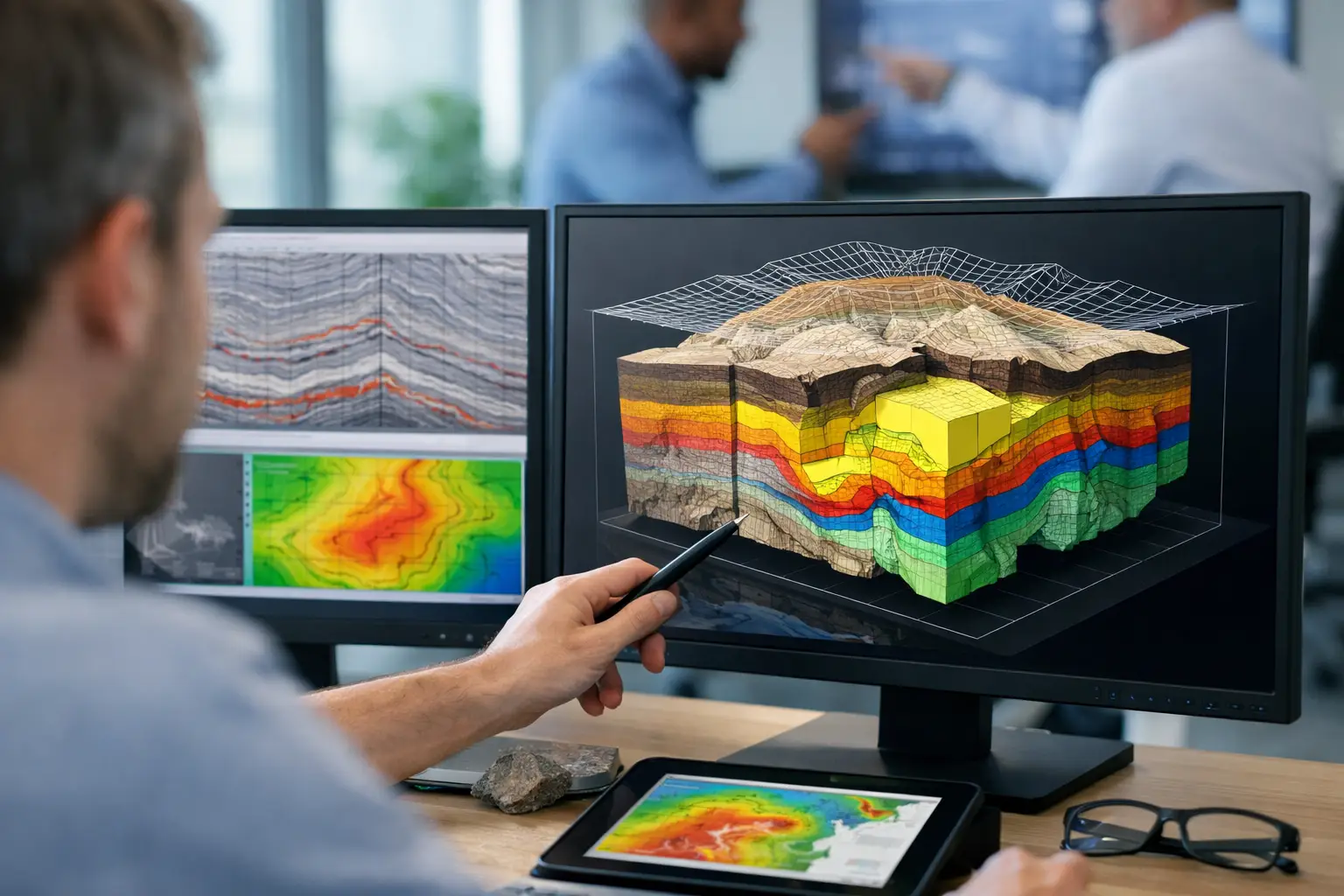
A drilling location can look favorable on a topographic map and still fail because the controlling structure lies beneath cover. A utility corridor can appear clear until excavation encounters an undocumented line. For these decisions, subsurface mapping solutions must do more than collect sensor readings. They must produce calibrated, spatially controlled, and interpreted evidence that technical teams can defend in a planning meeting, a design review, or an investment decision.
The strongest programs combine airborne and ground-based geophysics with terrain intelligence, field verification, and documented QA/QC. The objective is not a visually impressive map. It is a decision-grade model of what is likely below the surface, where uncertainty remains, and what action should follow.
What subsurface mapping must answer
Subsurface conditions are rarely represented by one physical property. Magnetic surveys respond to contrasts in magnetic susceptibility and remanence. Electromagnetic methods respond to conductivity. Radiometric surveys characterize near-surface geochemistry. Ground-penetrating radar can resolve shallow interfaces where soil conditions permit. LiDAR and photogrammetry establish the terrain, drainage, structures, and surface expressions that give geophysical anomalies geological context.
A mapping program should begin with the decision, not the sensor. An exploration manager may need to trace concealed faults, map lithological contacts, or prioritize drill targets. A hydrologist may need to identify fracture zones, weathered bedrock, paleochannels, or probable groundwater-bearing intervals. An EPC team may be assessing utility conflict risk, void potential, or terrain constraints along a corridor.
These objectives require different survey geometry, line spacing, altitude, sensor combinations, and interpretation workflows. A broad reconnaissance survey can identify regional trends efficiently, but it may not resolve the geometry needed for engineering design. Conversely, a high-density survey over a small area may be technically excellent while failing to establish the regional controls that explain an anomaly. Scope discipline determines whether data acquisition produces useful intelligence or expensive ambiguity.
The sensing stack behind effective subsurface mapping solutions
No single modality provides a complete subsurface answer. Multi-sensor integration is valuable because each method constrains a different part of the geological or engineered system.
Aeromagnetics for structure and lithology
Drone-borne magnetic surveys provide high-resolution measurements of the Earth’s magnetic field across areas that are difficult, slow, or unsafe to traverse on foot. After correction for diurnal variation, positioning effects, sensor heading, and platform noise, magnetic data can reveal faults, dikes, contacts, basement architecture, alteration patterns, and buried ferrous infrastructure.
Magnetics is particularly effective when a target has meaningful magnetic contrast with surrounding material. It is less definitive where the geology is magnetically uniform, where cultural interference is significant, or where a nonmagnetic target is the primary concern. Interpretation must therefore distinguish between a mapped anomaly and a proven geological body. The former is evidence; the latter requires corroboration.
Electromagnetics for conductivity contrasts
Electromagnetic surveys measure the response of the ground to induced electromagnetic fields. They are often deployed to investigate conductive zones associated with groundwater, clay-rich weathering, saline conditions, sulfides, buried channels, or utilities.
Conductivity alone does not identify material type. A conductive response may indicate water-bearing fractures, saline groundwater, clay, metallic infrastructure, or mineralization. That ambiguity is not a failure of the method. It is the reason EM results should be evaluated alongside geology, magnetic signatures, terrain, existing boreholes, and targeted ground verification.
LiDAR and photogrammetry for the surface framework
Subsurface interpretation improves when the surface model is accurate. LiDAR can produce a high-density terrain model through sparse vegetation and quantify subtle geomorphic features, while photogrammetry delivers detailed imagery and surface models for site planning, change detection, and visual inspection.
In arid environments, these datasets can expose drainage pathways, fault scarps, lineaments, abandoned workings, erosion patterns, and access constraints. They also establish accurate elevation control for geophysical processing. A weak terrain model can introduce errors into flight planning, terrain clearance, and the geological interpretation built on top of the data.
GPR and targeted ground investigation
Ground-penetrating radar can provide high-resolution imaging of shallow utilities, voids, pavement layers, and near-surface interfaces. Its performance depends heavily on site conditions. Dry, resistive materials may support strong penetration, while conductive soils, saline ground, and some clays can significantly limit depth.
For critical locations, targeted ground investigation remains essential. Boreholes, trenching, test pits, laboratory results, and known utility records convert a geophysical model from an informed interpretation into a cross-validated site understanding. The correct approach is progressive: survey broadly, focus the target, then verify where the decision risk is highest.
Survey design determines data value
A sensor specification does not guarantee a useful survey. The value of a dataset is controlled by how the mission is designed, executed, and processed.
Line orientation should be selected relative to expected geological strike or corridor geometry. Line spacing must be matched to the smallest feature that needs to be resolved. Flight altitude affects signal strength and spatial resolution, but lower is not always better if terrain, obstacles, safety margins, or platform noise compromise consistent acquisition. Tie lines, repeat traverses, base-station monitoring, and calibration checks are not administrative additions. They provide the controls needed to detect drift, level the dataset, and demonstrate repeatability.
For drone operations, terrain-following capability and flight planning matter greatly in rugged or desert environments. Consistent sensor-ground separation improves the comparability of measurements across the project area. Rapid mobilization is commercially valuable only when it is paired with controlled field procedures, verified positioning, and a documented chain from acquisition through final deliverable.
From anomaly map to interpreted intelligence
Raw data is not a decision product. A technically mature workflow moves through several controlled stages: acquisition planning, instrument calibration, field QA/QC, data correction, processing, inversion or enhancement where appropriate, geological integration, interpretation, and reporting.
For magnetic data, this may include removal of temporal variation, compensation for platform effects, leveling, micro-leveling, reduction and derivative products, and structural interpretation. For EM, processing may involve filtering, calibration, inversion, conductivity-depth modeling, and comparison against borehole or geological data. The proper workflow depends on the survey system and target depth, so standard processing templates should never replace project-specific technical judgment.
The final package should clearly separate observations from interpretations. It should identify anomalies, confidence levels, assumptions, processing parameters, coordinate reference systems, coverage limits, and recommended follow-up actions. This is what makes the result auditable. A project owner should be able to ask why a target was ranked highly and trace the answer back through the source data, QA records, and interpretive rationale.
Sector applications where uncertainty carries cost
In mining, subsurface intelligence supports target generation, structural mapping, alteration studies, and drill program optimization beneath transported cover. High-resolution aeromagnetics and EM can reduce the area requiring expensive ground follow-up, particularly when interpreted against regional geology and surface mapping.
For groundwater programs, integrated magnetic, EM, terrain, and remote-sensing data can help define fracture corridors, basin geometry, recharge pathways, and prospective zones for field confirmation. It cannot guarantee yield without drilling and testing, but it can materially improve where those investments are made.
For infrastructure and utilities, the priority is often risk reduction rather than resource discovery. Mapping can support corridor planning, locate likely buried utilities, identify shallow anomalies requiring investigation, and characterize terrain conditions before detailed engineering. In dense industrial areas, cultural interference and incomplete legacy records require especially careful data screening and verification.
Saudi Arabia’s large-scale mining, water, energy, and development programs make rapid, desert-ready surveying particularly relevant. In these operating environments, aircraft availability, ground access, heat, and schedule pressure can all affect project delivery. Drone-based systems can shorten mobilization and improve coverage, provided their limitations, airspace requirements, and QA controls are managed with the same discipline as the geophysical interpretation.
Selecting a capable delivery partner
Technical procurement should assess more than equipment inventory. Ask how the provider establishes positional accuracy, controls sensor noise, validates calibration, manages diurnal effects, and documents field exceptions. Request examples of the final interpreted outputs, not only sample images of colored anomaly maps.
The most useful questions concern decision relevance. What is the anticipated depth of investigation? What target size and contrast can realistically be detected? Which findings require field verification? What uncertainty remains after processing? A qualified provider will state those boundaries directly rather than promise certainty where the physics does not support it.
Air Solutions applies this approach through drone-based multi-sensor acquisition, cross-validated interpretation, and auditable reporting designed for industrial and infrastructure decisions. The requirement is simple: deliver data that can withstand technical scrutiny and improve the next action on site.
The practical test for any subsurface program is not whether it produces an anomaly. It is whether the project team can use that anomaly to place the next borehole, reroute the next corridor segment, prioritize the next inspection, or avoid a costly field decision made with incomplete evidence.