
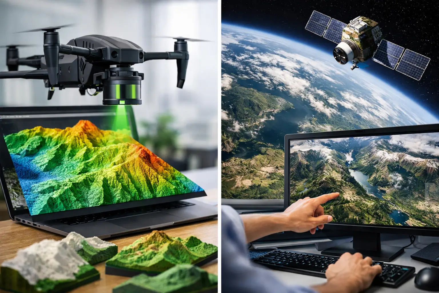
A 10-meter elevation model can identify a regional drainage basin. It cannot reliably confirm whether a proposed access road will cross a berm, a shallow wadi, an active utility corridor, or a grade break that will affect earthworks quantities. That is the operational distinction behind lidar vs satellite terrain data: both describe landform, but they support very different levels of engineering, resource, and infrastructure decision-making.
For project owners, the question is not which dataset is universally better. It is whether the data resolution, vertical accuracy, acquisition date, surface penetration, and quality controls are appropriate for the decision being made. A regional screening study and a final design package should not be built on the same terrain specification.
LiDAR vs Satellite Terrain Data: The Core Difference
Satellite terrain data is generally derived from optical stereo imagery, radar interferometry, or broad-area satellite elevation missions. It offers large geographic coverage and can be obtained quickly for desktop studies, route alternatives, regional hydrology, reconnaissance geology, and preliminary site selection. Its value is scale.
LiDAR measures terrain directly with laser pulses from an airborne platform. A calibrated LiDAR system records millions of range measurements, then classifies returns to distinguish ground from vegetation, structures, vehicles, and other surface features. The resulting bare-earth digital terrain model, or DTM, can resolve subtle terrain conditions that broad-area satellite products commonly generalize or miss.
This difference matters most where the physical surface controls cost, risk, safety, or regulatory compliance. Mine haul-road design, flood-path assessment, transmission-line routing, pipeline corridor engineering, quarry volumetrics, drainage design, and construction progress verification all require terrain intelligence that is spatially detailed and technically defensible.
| Decision factor | Satellite terrain data | Airborne LiDAR terrain data | |---|---|---| | Typical coverage | Regional to continental | Site, corridor, district, or targeted regional survey | | Ground sampling | Often meters to tens of meters | Commonly sub-meter to meter-scale, based on flight design | | Vegetation and surface clutter | Usually represents the visible surface | Multiple returns can support ground classification | | Acquisition control | Limited to available archive or tasking schedule | Project-specific timing, flight geometry, and coverage | | Best use | Screening, context, preliminary alternatives | Engineering, inventories, design, and auditable measurements |
The specifications vary by source and survey design. A LiDAR dataset is not automatically fit for purpose simply because it has a dense point cloud, and a satellite model is not automatically unsuitable because it has a coarser pixel size. The required tolerance and the consequences of an incorrect decision must drive selection.
Resolution Is Not the Same as Accuracy
Procurement teams often compare datasets by pixel size alone. That approach is incomplete. A one-meter digital elevation model may have excellent visual detail but poor vertical control if it was generated without adequate ground control, trajectory processing, or validation. Conversely, a coarser model may be entirely adequate for strategic corridor screening.
For LiDAR, the relevant technical questions include point density, scan angle, overlap, sensor calibration, GNSS and inertial measurement unit performance, ground-control configuration, classification methodology, and independent checkpoints. These factors determine whether the delivered DTM is traceable to a defined vertical datum and meets the project accuracy requirement.
Satellite terrain products introduce different controls. Their elevation may be affected by stereo matching error, radar geometry, cloud conditions, atmospheric conditions, shadow, terrain slope, and the date of source imagery. In mountainous ground or dense urban environments, these effects can become material. A terrain surface created from satellite imagery may also represent roofs, tree canopies, or other above-ground features rather than bare earth.
The practical test is straightforward: can the dataset be cross-validated against surveyed checkpoints and documented tolerances? If the answer is no, it should be treated as planning intelligence, not final engineering control.
Surface Model Versus Bare-Earth Model
A second source of confusion is the distinction between a digital surface model, or DSM, and a digital terrain model. A DSM captures the uppermost visible surface. In a developed corridor, that may include buildings, stockpiles, transmission structures, trees, and equipment. A DTM attempts to represent the ground beneath those objects.
Satellite-derived products are frequently closer to a DSM, particularly in vegetated or built environments. LiDAR can generate both products because multiple laser returns and classification routines provide a basis for filtering non-ground features. Results still depend on terrain type and the classification workflow. Dense vegetation, steep cut faces, water, highly reflective surfaces, and complex industrial facilities require disciplined review rather than automatic processing alone.
For mining and infrastructure work, this distinction directly affects volume calculations, drainage modeling, clearance analysis, slope characterization, and route design. A canopy or rooftop mistakenly retained as terrain can produce a convincing map and a costly design error.
When Satellite Terrain Data Is the Right Choice
Satellite data is often the correct starting point when a project team needs broad context before committing to field mobilization. It supports early-stage assessment of catchments, ridgelines, access constraints, regional structural trends, possible route corridors, and terrain-driven environmental considerations.
It is also useful when the area of interest is very large and the required decision is comparative rather than dimensional. For example, a developer assessing multiple potential sites may need to understand which areas have generally favorable slopes and drainage patterns. Satellite terrain data can narrow the search area before a targeted airborne survey is commissioned.
Its limitations should be stated clearly in reporting. Archive data may predate new roads, excavation, erosion, construction activity, or changing watercourses. In fast-moving industrial environments, acquisition date is a technical parameter, not an administrative detail. A terrain model captured before site grading or a flood event may not represent present conditions.
When LiDAR Becomes the Defensible Option
LiDAR becomes the stronger option when terrain needs to be measured rather than broadly interpreted. This includes design-grade topographic base mapping, detailed cut-and-fill analysis, flood and drainage studies, stockpile and quarry volume measurement, high-resolution corridor mapping, and terrain characterization around critical assets.
Drone-based LiDAR is particularly effective for targeted sites and linear corridors where rapid mobilization, controlled acquisition timing, and safe stand-off from hazardous ground are priorities. In desert and remote operating environments, it can also reduce the exposure and time associated with extensive ground survey while maintaining a defined QA/QC framework.
A well-designed survey does more than collect a point cloud. The workflow should establish survey control, calibrate the sensor and trajectory, plan flight lines for coverage and geometry, classify ground and non-ground returns, inspect artifacts, generate terrain derivatives, and validate outputs using independent checkpoints. Deliverables should specify coordinate reference systems, vertical datum, acquisition parameters, accuracy results, processing methods, and known limitations.
That audit trail is what allows engineers, geologists, owners, and regulators to understand how the terrain model was produced and whether it is suitable for downstream use.
The Cost Question Should Include Decision Risk
Satellite terrain data appears inexpensive because much of it is available as existing coverage. For a desktop assessment, that economic advantage is real. The mistake is extending that logic into decisions where terrain uncertainty creates redesign, rework, field verification, or claims exposure.
LiDAR carries mobilization, flight, processing, and validation costs. Yet its project value can exceed those costs when it reduces ground investigation requirements, shortens design iteration, identifies terrain constraints early, or provides a consistent baseline for quantity tracking and change detection.
The correct comparison is therefore not acquisition cost per square kilometer. It is the cost of obtaining sufficient confidence for the next project gate. A regional prospecting program may reasonably begin with satellite terrain. A final alignment, drainage network, or earthworks quantity estimate generally demands higher-resolution, independently validated terrain control.
Build the Terrain Specification Around the Decision
The most effective terrain-data procurements begin with intended use, not sensor preference. Define the area and corridor width, required horizontal and vertical tolerance, deliverable types, coordinate and vertical reference systems, target acquisition window, ground-cover conditions, and acceptance testing method. Require clarity on whether the requested model is a DSM, a DTM, or both.
For integrated resource and infrastructure projects, terrain should also be considered alongside the other information layers that govern the decision. High-resolution LiDAR can be fused with orthophotography, hyperspectral data, magnetic surveys, utility detection, and field observations to relate terrain form to geology, drainage, asset location, and construction constraints. This is where airborne data moves beyond mapping into interpreted geospatial intelligence.
Air Solutions applies this decision-led approach by designing survey specifications around the engineering or geoscience question, then delivering calibrated, cross-validated outputs with documented QA/QC rather than uncontextualized sensor files.
The next terrain model should not be selected because it is the finest available or the cheapest to download. Select the model whose accuracy, date, surface definition, and traceability match the risk of the decision it will support.