A potassium anomaly over shallow cover can change a drilling program. A thorium-to-uranium ratio shift can alter how a regolith model is interpreted. In practice, radiometric survey applications are not academic add-ons - they are operational inputs that affect targeting, risk, permitting, and field logistics.
For enterprise buyers, the value is straightforward. Radiometric data helps identify surface and near-surface geochemical patterns at scale, often faster and with better spatial continuity than ground-only methods. When acquired with calibrated systems, processed under controlled QA/QC, and interpreted alongside magnetics, LiDAR, or hyperspectral data, it becomes decision-grade intelligence rather than a colorful map.
Where radiometric survey applications deliver the most value
Radiometric surveys measure natural gamma radiation associated primarily with potassium, uranium, and thorium. That makes them especially effective where the project question depends on lithology discrimination, alteration mapping, transported cover characterization, or radiological baseline assessment.
In mineral exploration, this is one of the most established radiometric survey applications. Potassic alteration can indicate hydrothermal systems. Thorium responses may help separate felsic units from mafic or sedimentary sequences. Uranium channel behavior can assist in identifying redox conditions, surficial redistribution, or potential mineralization pathways. The key point is that radiometrics rarely works best in isolation. Its value increases when interpreted as part of a fused geoscience model.
In groundwater and hydrogeological programs, radiometric signatures can help refine surface geology and weathering profiles that influence recharge, permeability trends, and structural controls. This is not a direct aquifer detector, and treating it as one is a mistake. What it does well is improve the geological context used to position other investigations, including electromagnetic surveys, structural mapping, and targeted drilling.
For infrastructure and corridor planning, radiometric datasets support terrain intelligence where material characterization matters. Variations in surficial composition, weathered bedrock, and alluvial cover can inform route assessment, borrow source evaluation, and geotechnical risk screening. In remote or desert environments, airborne radiometrics also reduces dependence on dense ground traverses in difficult terrain.
Environmental and regulatory use cases are equally relevant. Baseline radiological mapping before development, industrial expansion, or remediation establishes a traceable reference condition. That matters for permitting, future audits, and stakeholder confidence. In post-disturbance settings, repeat surveys can be used to assess whether surface redistribution has altered radiological patterns in a measurable way.
Why airborne radiometrics is increasingly preferred
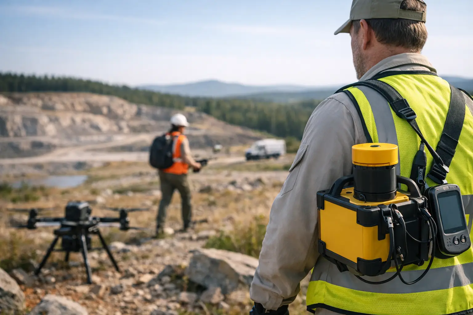
Ground spectrometry still has a place, especially for calibration support, follow-up validation, and highly localized studies. But at project scale, airborne collection offers a different operating model. Large areas can be covered quickly, line spacing can be controlled to suit the target, and data density remains consistent across terrain that would slow or expose ground crews.
For projects in Saudi Arabia and the Gulf, environmental conditions are not a side issue. Heat, access constraints, and large concession footprints all affect survey economics and schedule certainty. Drone-based airborne systems are well suited to these conditions because they mobilize quickly, maintain low-altitude acquisition profiles, and can be deployed in areas where manned aircraft are inefficient or ground methods are too slow.
That said, altitude control, sensor stabilization, background correction, and calibration discipline are non-negotiable. Poor flying practices or weak processing can degrade signal quality quickly. Radiometric data is highly sensitive to survey design, and procurement teams should treat methodology as seriously as sensor specifications.
Radiometric survey applications in mining workflows
Mining programs often get the highest return when radiometrics is inserted early enough to influence exploration design, not simply to decorate a final interpretation package. Used properly, it helps prioritize traverses, focus trenching, and refine target ranking.
Lithological mapping and regolith discrimination
Radiometric responses often improve the distinction between rock types that are visually subtle or partly obscured. In weathered terrains, potassium, thorium, and uranium distributions can help map regolith domains and transported cover boundaries. That directly affects how geochemical results are normalized and how anomalies are ranked.
Alteration detection and target vectoring
Potassic enrichment is often operationally useful in porphyry, intrusive, and hydrothermal systems. It does not prove economic mineralization, but it can support vectoring when aligned with structural data, magnetics, and surface mapping. The trade-off is that weathering and surficial processes can overprint primary signatures, so interpretation must remain geologically controlled.
Uranium exploration and radiological screening
In uranium-focused work, radiometrics has obvious direct value. It can also support broader mineral programs by screening naturally radioactive zones that may affect field protocols, sample handling, or future development planning. For owners and operators, that is not just exploration intelligence - it is also an HSE input.
Water, infrastructure, and environmental use cases
Radiometric survey applications extend well beyond the mining sector, especially where geological surface mapping is a constraint on planning quality.
Groundwater prospectivity support
Radiometrics contributes to groundwater studies by clarifying lithological boundaries, weathering patterns, and structural trends that influence recharge and storage. It should be paired with electromagnetic or resistivity methods where subsurface conductivity is the primary decision variable. In other words, radiometrics frames the problem; other sensors often test it at depth.
Linear infrastructure and site development
Roads, pipelines, transmission corridors, and industrial facilities all benefit from faster regional screening. Radiometric mapping can identify material contrasts, surface contamination concerns, and terrain domains requiring more detailed investigation. For EPC teams, this supports earlier risk segmentation and better allocation of intrusive testing.
Baseline and compliance-driven surveys
Where projects require documented pre-development conditions, radiometric mapping provides a repeatable baseline. The benefit is strongest when acquisition parameters, calibration records, and processing steps are fully auditable. That audit trail matters later, especially if operational changes, remediation obligations, or third-party review become part of the project lifecycle.
What separates useful data from decision-grade data
Not all radiometric outputs deserve the same level of trust. Enterprise users should focus on whether the survey has been designed and executed to support defensible decisions.
First, line spacing and flight altitude must match the target scale. A survey designed for regional reconnaissance should not be marketed as detailed targeting data. Second, calibration and correction workflows must be documented. Background subtraction, height correction, spectral stripping, and leveling all influence interpretability. Third, interpretation should be cross-validated against geology, field observations, and other geophysical layers.
This is where many projects either gain or lose value. A raw ternary image may look informative, but without controlled processing and geological context, it can lead teams toward false correlations. Decision-makers need interpreted outputs tied to project questions - not just imagery.
A disciplined provider will define acquisition tolerances, maintain sensor traceability, document QC exceptions, and present limitations clearly. That last point matters. Some terrains, moisture conditions, and cover types reduce effectiveness. Strong technical partners state those constraints early instead of overselling the method.
Multi-sensor integration is where radiometrics becomes strategic
The strongest case for radiometric mapping is rarely the radiometric layer alone. Its strategic value comes from integration.
Radiometrics paired with magnetics can separate lithological units while highlighting alteration or weathering effects. Combined with LiDAR, it gains topographic context that improves terrain correction and geomorphological interpretation. Used with hyperspectral data, it can correlate geochemical radiometric patterns with mineralogical surface expressions. In hydrogeology, adding electromagnetics helps connect surface geochemistry to subsurface conductivity architecture.
For procurement teams and technical evaluators, this matters because it shifts radiometrics from a single-sensor purchase to a broader intelligence workflow. The outcome is not simply more data. It is a more constrained geological model, fewer unnecessary field campaigns, and faster progression from reconnaissance to engineering action.
That is the operating logic behind advanced drone survey programs. A contractor such as Air Solutions is not just flying a sensor package. The deliverable is a calibrated, cross-validated, and sector-specific interpretation set that can stand up to internal technical review and external scrutiny.
How to evaluate fit before commissioning a survey
The central question is not whether radiometrics works. It is whether it fits the decision you need to make.
If the objective is lithological mapping, alteration screening, radiological baseline definition, or regolith characterization, the method is often highly effective. If the objective is deep subsurface imaging or direct groundwater detection, radiometrics alone is not enough. The right survey scope depends on geology, cover conditions, terrain, and the business consequence of being wrong.
A disciplined scoping phase should define the target, expected signal source, optimal altitude, line spacing, calibration plan, and integration requirements with other datasets. That front-end rigor usually saves money because it prevents underpowered surveys and avoids collecting data that cannot support the final decision.
The most useful way to think about radiometric survey applications is as a precision layer in a larger geospatial system. When the survey is calibrated, traceable, and interpreted against the right geological question, it shortens the distance between field acquisition and action. That is where the method earns its place - not as a standalone map product, but as a faster route to defensible decisions.