When a project team asks whether to commission magnetics vs electromagnetic surveys, the real question is usually more specific: are we trying to map structure, detect conductivity, reduce drilling risk, or screen a large concession fast enough to support a capital decision? The distinction matters because these methods respond to different physical properties, carry different depth and resolution trade-offs, and produce different levels of decision value depending on the target.
For technically informed buyers, the issue is not which method is better in the abstract. It is which method is calibrated to the geology, infrastructure constraints, and decision window of the program. In mining, water, utilities, and corridor development, the wrong survey design does not just waste budget. It can distort targeting logic, delay engineering, and force rework across downstream interpretation.
Magnetics vs electromagnetic surveys - the core difference
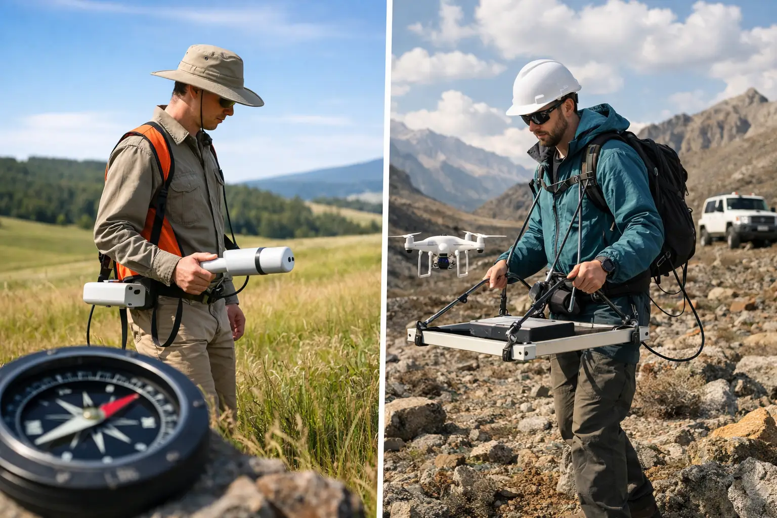
Magnetic surveys measure variations in the Earth’s magnetic field caused by contrasts in magnetic susceptibility and remanence. In practical terms, magnetics is highly effective for mapping lithology, structure, basement architecture, dikes, faults, and alteration patterns where magnetic minerals create usable contrast. It is often the fastest way to build regional structural context over large areas.
Electromagnetic surveys, by contrast, measure subsurface conductivity or resistivity behavior by inducing or observing electromagnetic fields. That means EM is designed to respond to conductive bodies such as sulfides, saline groundwater, clay-rich zones, leachate plumes, and buried metallic infrastructure. Where magnetics excels at mapping magnetic fabric and structural geometry, EM is built to identify conductive targets and conductivity contrasts.
That distinction sounds simple, but it drives almost every operational decision that follows. If the target is a magnetite-rich banded iron formation, magnetics may carry the program. If the target is a conductive sulfide body under cover, EM can be the primary discriminator. If the objective is groundwater characterization in a saline or clay-sensitive environment, EM often delivers the more direct response. If the objective is regional fault tracing and lineament mapping beneath shallow cover, magnetics usually enters first.
Where magnetics has the advantage
Magnetics is typically the more efficient tool for regional reconnaissance. It mobilizes quickly, covers large areas at high speed, and can generate a coherent structural framework even where outcrop is poor. For exploration managers, that matters because early-stage programs often need to sort vast terrain into priority domains before committing more specialized methods.
Another advantage is interpretive stability. Magnetic datasets often provide clean, mappable signals that support derivative products such as analytic signal, tilt derivative, and depth-to-source estimates. Those products are valuable for tracing faults, contacts, intrusions, and basement relief with a high level of spatial continuity.
In infrastructure and corridor planning, magnetics can also support geologic hazard screening by identifying buried structural features or ferrous anomalies relevant to route selection. It is not a universal utility-mapping tool, but in the right setting it contributes useful subsurface context with low operational burden.
The limitation is equally clear. Magnetics does not directly measure conductivity, salinity, porosity, or groundwater quality. A non-magnetic but highly conductive target may be weak or invisible in magnetic data. Strong magnetic structure can also be geologically informative without answering the commercial question the client actually needs resolved.
Where electromagnetic surveys have the advantage
Electromagnetic methods are stronger when conductivity is the controlling property. That makes them especially relevant for massive sulfide exploration, groundwater assessment, environmental investigations, and utility or buried object detection where conductive contrast is decisive.
In groundwater programs, EM can help distinguish fresh and saline water regimes, define conductive overburden, and support hydrogeologic modeling in ways magnetic data cannot. In mining, it can directly elevate conductive targets that warrant follow-up drilling, particularly under transported cover where surface mapping adds limited value.
EM is also more sensitive to certain near-surface and mid-depth features that are commercially important but magnetically subdued. Conductive faults, alteration halos with clay development, and buried anthropogenic features may all be clearer in EM response.
The trade-off is that EM data can be more complex to acquire and interpret. Conductivity responses are influenced by target geometry, depth, host conductivity, cultural noise, and system configuration. In highly conductive near-surface conditions, deeper targets can become harder to resolve. That does not reduce EM’s value. It means survey design, calibration, and QA/QC discipline matter even more.
Depth, resolution, and ambiguity
One of the most common procurement mistakes is to compare magnetics and EM as if they operate at a single depth or resolution. They do not. Depth of investigation depends on platform altitude, line spacing, sensor type, geology, target size, and noise environment.
Magnetics can detect deeper sources, especially broad basement or intrusive features, but deeper detection does not always mean precise target discrimination. EM can be more selective for conductive bodies, yet depth penetration may be constrained by system physics and near-surface conductivity. In other words, magnetics often gives a broader structural picture, while EM can provide a more direct response to specific conductive targets within a defined depth envelope.
Ambiguity also differs between the methods. A magnetic anomaly may indicate a lithologic contact, a faulted block, a mafic unit, cultural metal, or remanent magnetization effects. An EM anomaly may reflect sulfides, clays, saline water, infrastructure, or conductive overburden. Neither dataset should be treated as self-executing truth. Decision-grade interpretation depends on cross-validation with geology, topography, existing borehole control, and where available, complementary sensors.
Magnetics vs electromagnetic surveys in real project settings
In hard-rock mineral exploration, magnetics is often commissioned first to define structural architecture, intrusive centers, and stratigraphic controls across a large license area. EM is then deployed to test conductive targets within that framework. This sequence reduces uncertainty efficiently because the magnetic survey organizes the geology, while EM sharpens target selection.
In groundwater and environmental work, the order may reverse. If the main objective is identifying conductive aquifers, salinity interfaces, or contaminated plumes, EM may be the primary survey and magnetics a secondary layer used to understand basement or structural controls on flow.
For utilities and infrastructure, project scale determines the method mix. A regional corridor study may begin with magnetics to establish broad geologic and ferrous anomaly context. A localized engineering package focused on buried conductive assets, trenching risk, or subsurface interference may depend more heavily on EM.
This is why serious survey planning starts with the decision to be made, not the sensor to be flown. Method selection should follow target physics, economic consequence, and required reporting confidence.
Why integrated acquisition usually outperforms single-sensor logic
For many enterprise programs, the most effective answer to magnetics vs electromagnetic surveys is not either-or. It is staged or integrated acquisition. Magnetic data provides structural context and geologic continuity. EM contributes conductivity discrimination. Together, they reduce interpretive blind spots.
This integrated approach is particularly valuable in frontier areas, covered terranes, and fast-moving development environments where there is limited appetite for multiple remobilizations. Drone-based acquisition has made that operating model more practical by allowing rapid deployment, lower-altitude flying, tighter line spacing, and repeatable coverage in areas where conventional methods may be slower, costlier, or operationally constrained.
For buyers, the advantage is not just sensor efficiency. It is the ability to receive fused and interpreted outputs that are traceable, cross-validated, and aligned to the project question. Raw datasets rarely shorten a board-level or engineering decision on their own. Interpreted geospatial intelligence does.
How to choose the right method
If the project depends on structural mapping across a large area, magnetics is usually the first call. If it depends on conductive target detection, EM moves to the front. If the geology is heterogeneous, the cover is thick, or the cost of a false negative is high, an integrated program is often justified.
Three practical filters help. First, identify the physical property that best represents the target - magnetic susceptibility or conductivity. Second, define the required depth and spatial resolution in commercial terms, not just technical ones. Third, assess the operating environment, including terrain access, cultural noise, heat, line spacing tolerance, and delivery timelines.
That framework is where specialist operators create measurable value. A disciplined contractor will not just recommend a sensor class. They will define acquisition parameters, calibration controls, compensation workflow, interpretive assumptions, and deliverable standards that make the data fully auditable. For organizations operating in mining, water, energy, and national infrastructure, that level of rigor is often the difference between survey data and a defensible basis for action.
Air Solutions approaches this problem as a geospatial intelligence task rather than a flight task. That distinction matters because enterprise clients do not buy airborne hours. They buy reduced uncertainty, faster mobilization, and reporting that stands up to technical and commercial scrutiny.
The better question is rarely magnetics vs electromagnetic surveys by itself. It is what combination of physics, platform, and interpretation gets you to a credible decision with the least wasted field effort. Start there, and the survey design becomes far more precise.