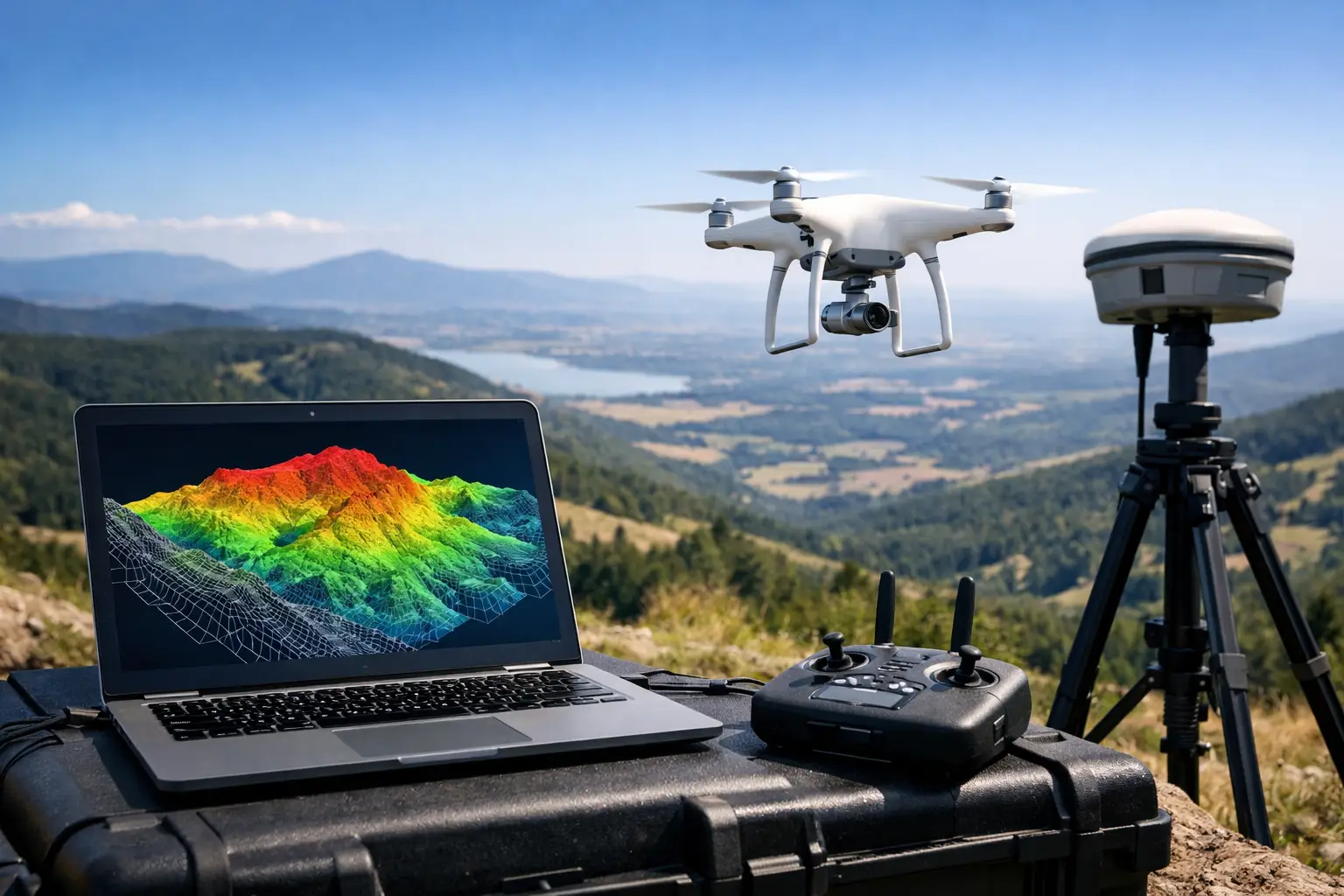
A haul road that appears serviceable on a standard orthomosaic can still carry a grade break severe enough to affect drainage, equipment movement, or cut-fill estimates. That is where a digital elevation model from drone survey data becomes operationally significant. For mining, water resources, utilities, and infrastructure programs, the value is not in a visually impressive surface. It is in a calibrated terrain product that can support engineering decisions, withstand QA/QC review, and be traced back to controlled acquisition and processing steps.
What a digital elevation model from drone data actually delivers
A digital elevation model from drone acquisition is a gridded representation of elevation derived from airborne measurements. In practice, that definition is too broad to be useful unless the buyer understands what surface is being modeled, how it was measured, and what level of vertical accuracy is defensible.
In drone programs, the elevation model usually originates from either photogrammetry or LiDAR. Photogrammetry derives elevation by matching overlapping images and reconstructing a dense point cloud. LiDAR measures distance directly with laser pulses and typically performs better in complex relief, low-texture terrain, and some sparse vegetation conditions. Both methods can produce high-value terrain intelligence, but they do not produce identical outputs and should not be treated as interchangeable.
For industrial use, the key distinction is often between a surface model and a terrain model. A surface model includes everything the sensor sees - ground, stockpiles, structures, vegetation, and equipment. A terrain model attempts to isolate bare earth. If a procurement document asks for a DEM without specifying which one is required, that ambiguity can propagate into design errors, volume disputes, or drainage misinterpretation.
How the drone-to-DEM workflow is controlled
The quality of the final model is largely established before the aircraft leaves the ground. Survey design, sensor selection, control strategy, and environmental constraints all shape the result.
Flight planning and sensor fit
The aircraft, sensor payload, altitude, overlap, and ground sample distance must match the site objective. A borrow pit requiring stockpile reconciliation has a different tolerance profile than a wadi catchment study or a corridor design package. Higher overlap may improve reconstruction stability in photogrammetry, but it also increases processing load. Lower altitude can improve detail, but it reduces area coverage per sortie. In harsh desert conditions, heat shimmer, wind, and low-contrast surfaces can degrade image matching if the mission profile is not adjusted.
LiDAR introduces different controls. Pulse density, scan angle, IMU quality, and GNSS performance become central. For broad infrastructure or utility corridors, LiDAR can offer better consistency where image texture is weak or where vertical elements complicate reconstruction.
Ground control, RTK, and geodetic discipline
A digital elevation model from drone data is only as reliable as its positional control framework. RTK and PPK workflows improve absolute positioning, but they do not eliminate the need for disciplined survey control. Ground control points and independent checkpoints remain critical where contractual accuracy matters.
This is especially relevant for enterprise clients operating across mixed coordinate systems, legacy baselines, or national grid requirements. Elevation can also be referenced incorrectly if geoid models, vertical datums, or transformation parameters are not handled properly. A model may look internally consistent and still be wrong in absolute terms.
Processing, classification, and filtering
Raw imagery or point clouds do not become decision-grade terrain products by default. They must be processed through documented workflows that include camera calibration review, bundle adjustment, point cloud generation, noise filtering, and surface classification.
For terrain extraction, classification is often the make-or-break step. Bare-earth modeling in active industrial sites is complicated by vehicles, temporary works, berms, cables, spoil heaps, and fragmented rock faces. Over-aggressive filtering can flatten real terrain. Under-filtering can retain objects that distort slope, volume, and runoff interpretation. The right balance depends on site morphology, sensor type, and the intended engineering use.
Accuracy is not a brochure number
Many discussions about drone-derived elevation products collapse into generic claims about centimeter-level accuracy. That language is rarely useful in procurement or technical review. Accuracy must be contextualized by terrain, sensor, control density, processing method, and validation protocol.
A flat, open site with strong control and favorable light conditions can support very strong results from photogrammetry. A steep excavation with repetitive texture or shadowed benches may not. Likewise, a single RMSE figure can conceal spatial bias if checkpoints are poorly distributed. For engineering and regulatory use, what matters is whether the validation design reflects the site and whether residuals are independently tested.
A defensible DEM package should state the coordinate reference system, vertical datum, acquisition date, platform and sensor configuration, control methodology, checkpoint results, processing software environment, grid resolution, and known limitations. Without that audit trail, the dataset may still be visually useful, but it is not fully auditable.
Where DEMs from drones create enterprise value
The commercial case for drone elevation modeling is strongest where terrain intelligence affects cost, schedule, safety, or asset performance.
Mining and quarry operations
In mining, a digital elevation model from drone platforms supports pit progression tracking, stockpile reconciliation, haul road grading, blast planning context, and rehabilitation monitoring. The speed advantage matters, but speed alone is not the differentiator. The real value is repeated, comparable surfaces acquired under controlled parameters, allowing operators to monitor change with confidence.
Water resources and drainage analysis
For hydrology and groundwater programs, terrain detail drives watershed interpretation, surface runoff modeling, channel morphology assessment, and flood pathway analysis. In arid environments, subtle topographic shifts can change drainage behavior materially. Drone-derived models can resolve local relief more effectively than many legacy datasets, provided the vertical controls are properly established.
Infrastructure, utilities, and corridor development
Roads, rail, pipelines, transmission corridors, and utility networks all depend on reliable elevation. Drone-based DEMs support route selection, grading studies, right-of-way analysis, earthworks estimation, and progress verification. They are particularly useful where project teams need rapid mobilization, localized updates, or repeat surveys during active construction.
The trade-offs buyers should evaluate
No elevation method is universally superior. The right choice depends on terrain cover, asset complexity, required tolerance, area size, delivery timeframe, and the downstream use of the data.
Photogrammetry is often cost-efficient and highly effective over open ground with strong image texture. It also produces rich visual outputs that help non-technical stakeholders interpret the site. But it can struggle in homogeneous surfaces, reflective terrain, deep shadows, or areas with limited visual features.
LiDAR typically offers stronger geometric consistency in difficult terrain and can improve ground detection under sparse vegetation. It usually carries higher equipment and processing cost, and the value proposition strengthens when the site conditions justify that premium.
There is also a scale question. Drone acquisition is highly efficient for targeted, high-resolution coverage, but very large regional extents may still require a hybrid strategy involving fixed-wing platforms, crewed airborne systems, or staged deployment. Mature programs choose methods based on project economics and data requirements, not on platform preference.
What sophisticated buyers should request
When commissioning a DEM, technical procurement teams should define the intended use before specifying the output. A model for conceptual planning is not the same as a model for construction staking support or volumetric reconciliation.
The scope should state whether the requirement is for DSM, DTM, or both, the horizontal and vertical reference framework, checkpoint validation expectations, required grid resolution, area of interest boundaries, breakline treatment if relevant, and the acceptable delivery formats. It should also ask how non-ground objects will be handled and whether the provider will supply interpreted outputs or only processed surfaces.
This is where specialist operators stand apart from commodity drone vendors. The difference is not just flight capability. It is the ability to align acquisition, geodetic control, QA/QC, classification logic, and reporting with the actual risk profile of the project. Air Solutions applies that model across industrial surveys where terrain is not a visualization exercise but a planning and assurance input.
Why the DEM should be treated as a managed data product
A digital elevation model from drone data should not be purchased as an isolated file. It should be treated as a managed geospatial product with lineage, validation, and operational context. That means version control for repeat surveys, traceable updates when earthworks change, and compatibility with the GIS, CAD, and modeling environments already used by engineering and planning teams.
When that discipline is in place, the DEM becomes more than a map layer. It becomes a reliable reference surface for estimation, design, compliance, and change detection across the life of the asset.
The practical question is not whether a drone can produce elevation data. It is whether the resulting model is accurate enough, documented enough, and relevant enough to support the decision that comes next.