Aeromagnetic & EM Surveys
Acquisition of high-resolution magnetic field data using UAVs to support geological exploration and detect subsurface mineral bodies.

Service Details
We deliver UAV-based aeromagnetic surveys using high-sensitivity magnetometers deployed under controlled flight grids. Data processing includes drift correction, noise filtering, and regional background removal.
Deliverables include:
- Total Magnetic Intensity (TMI) maps
- Vertical and horizontal derivative maps
- Preliminary 3D subsurface models
- Technical interpretation reports supporting drilling decisions
Related Services

Drone-Based Building Cleaning
Facade and high-rise cleaning using tethered drone systems for safe and continuous operations.
Learn More
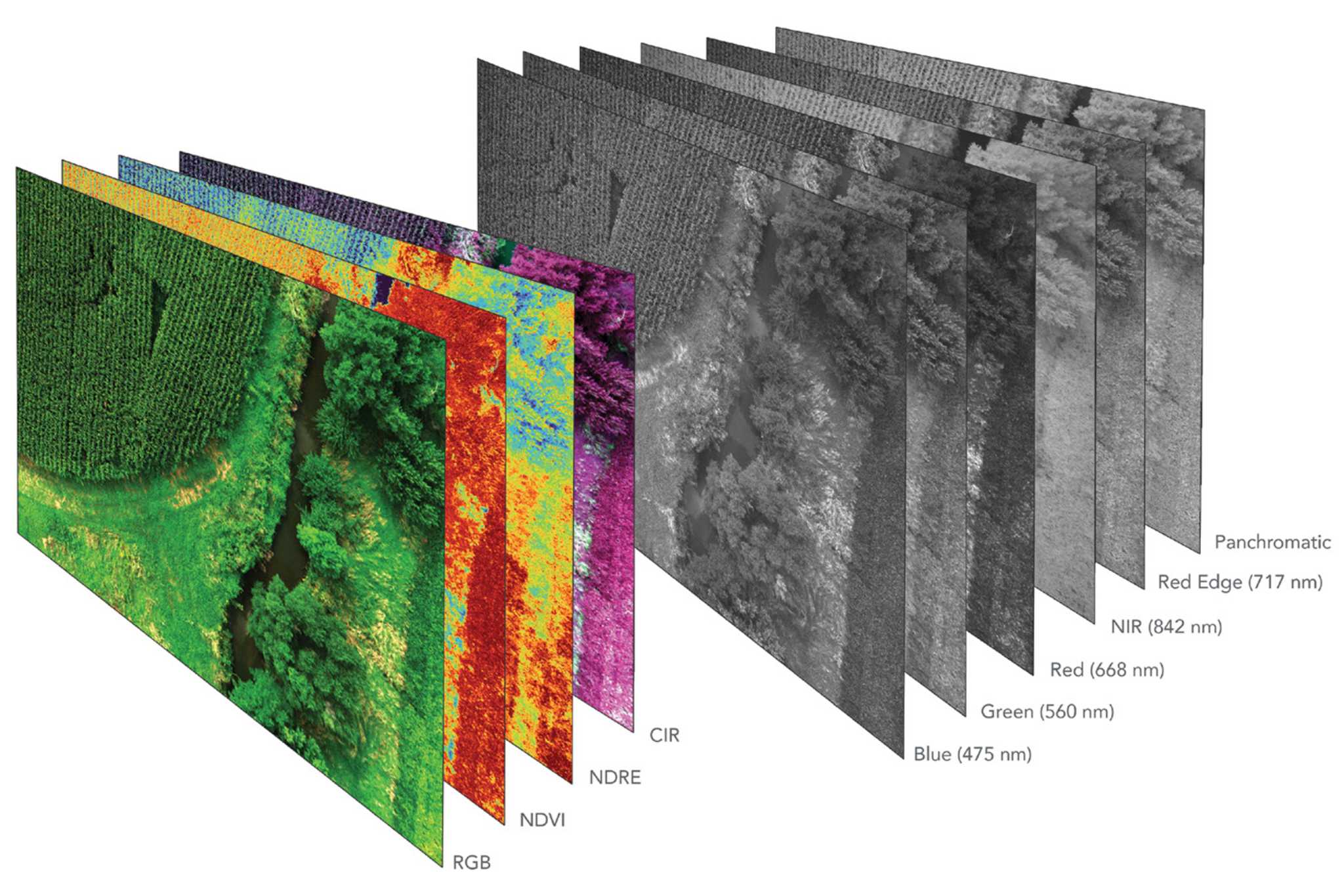
Multi & Hyperspectral Surveys
Spectral analysis of reflected light to assess vegetation health, environmental conditions, and subt...
Learn More
GPR & Underground Utilities Detection
Ground Penetrating Radar (GPR) surveys for accurate detection and mapping of buried infrastructure.
Learn More