Topographic Mapping
Generation of precise topographic maps and digital elevation models (DEMs) for engineering and planning purposes.
Service Details
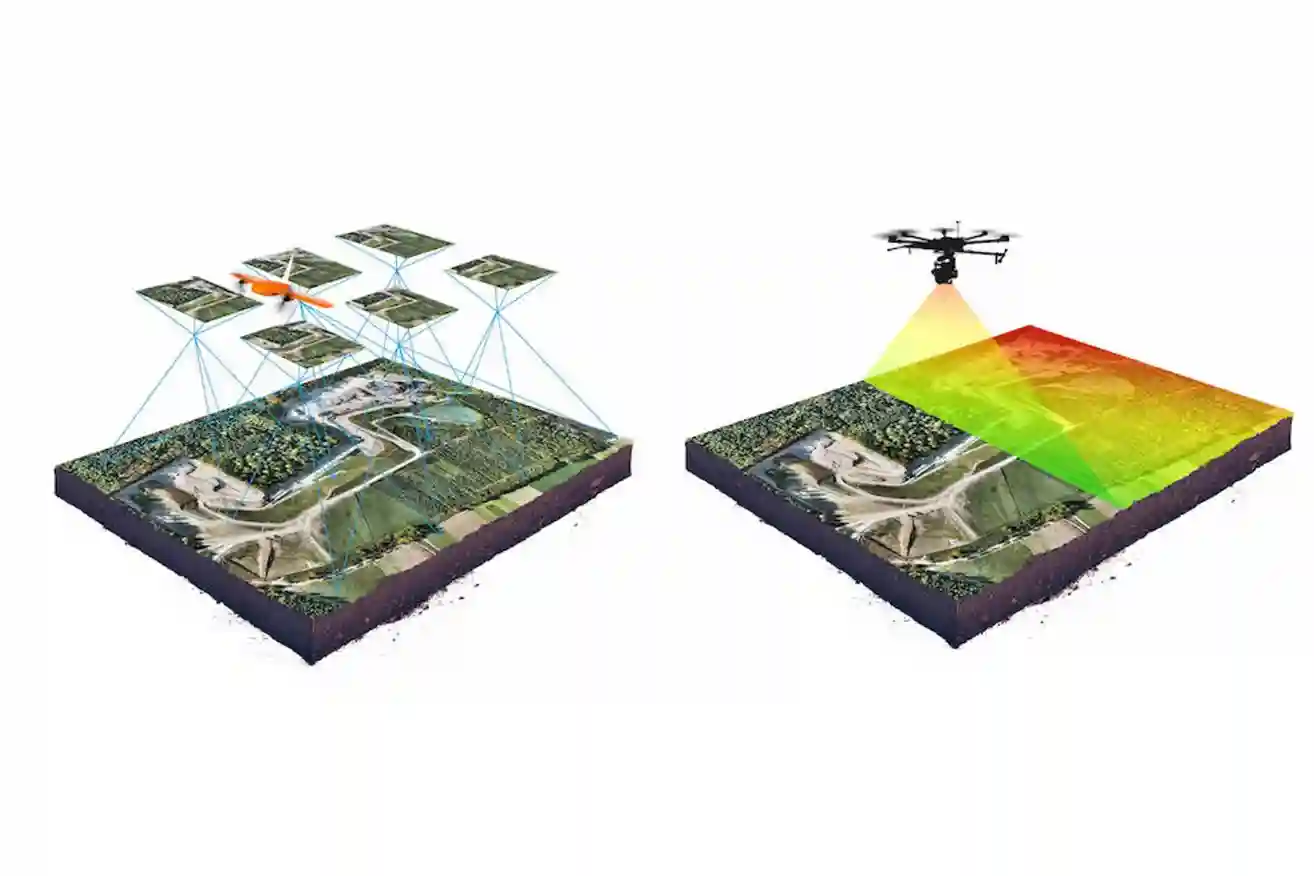
We provide UAV-based topographic surveys using photogrammetric processing to generate:
-
Digital Elevation Models (DEM / DSM)
-
Contour lines
-
Dense point clouds
-
High-accuracy survey maps
These outputs support engineering design, infrastructure planning, and cut-and-fill volume calculations.
Related Services
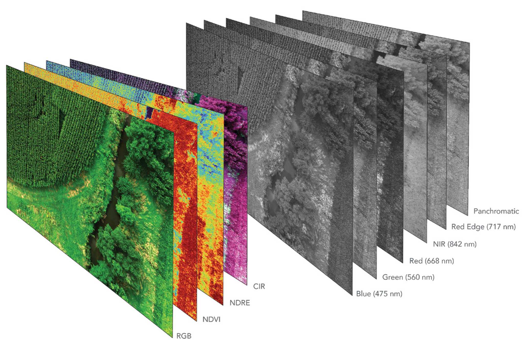
Multi & Hyperspectral Surveys
Spectral analysis of reflected light to assess vegetation health, environmental conditions, and subt...
Learn More

Drone-Based Building Cleaning
Facade and high-rise cleaning using tethered drone systems for safe and continuous operations.
Learn More
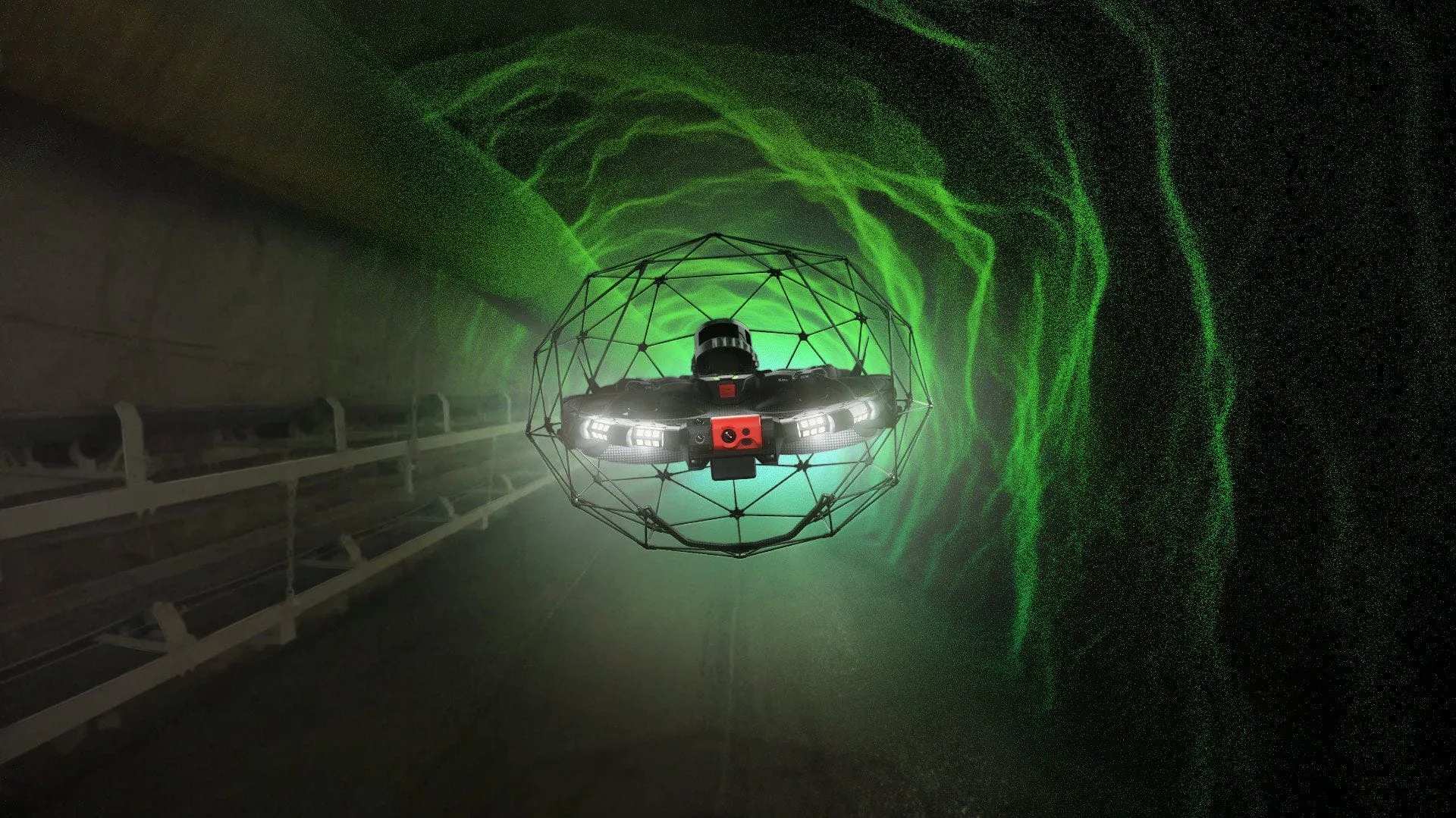
Confined Spaces Inspections
Inspection of tanks, tunnels, and enclosed industrial assets without human entry.
Learn More